I must say that it was with mixed feelings that I greeted the announcement (in 1985 I think) by then Minister for ‘Conservation’ Joan Kirner that Victoria would create/declare ‘Wilderness Areas’, the first being the Mt Darling – Snowy Bluff Wilderness Area where I have spent a lot of time (before and since). On the face of it there is a primordial yearning for a simpler time, an archetypal Eden perhaps where one might enjoy a ‘oneness’ with nature such as (you can imagine) existed in ‘happier’ times – but it is a delusion.
Such times (if they ever existed) are long gone, probably nearer a million years ago now when (no doubt) the earliest proto-humans, (whoever they were – their remains have not yet emerged) arrived in Australia. We do know that Australopithecus was present in Indonesia (and many other places) around that time and these little guys were clearly able to cross larger expenses of water than they would have faced (island-hopping) to arrive on our shores, so that I’m sure their remains are out there somewhere. Anyway it is preposterous to think that only one group of pre-European people made it to Australia. If one man can walk, so too can another.
An aside: Many aboriginal myths (and others) speak of ‘little people’ out there in the bush. The ‘pygmy people’ of Cape York are by now well-known as having persisted into the C20th as Tinsdale showed in this article. Tasmanians were pretty small and different too. The ‘one people’ notion of aboriginality is a political rather than a scientific or historical idea. But I have been puzzled a number of times over the years whilst hunting coming across tiny human footprints in the soft sand along remote creeks and gullies where it was extremely unlikely any camper or hunter had taken their children. What (or who) can have made them? Perhaps small groups of Australopithecus (or the like) still persist in remote patches of bush?
I have been visiting/exploring various parts of this vast Wilderness area over the years but mainly along the rivers and streams lower down (eg along the Wonnangatta/Moroka/Carey etc) as I prefer to camp by a stream rather than on a windy mountain-top but I have made several attempts over the years to wander out along the old (closed) road to Mt Darling which begins about fifty metres before Dimmicks Lookout (off the Howitt Rd above Tamboritha). It was (still) reasonably easy to walk out there ten years ago (in 2014).
A fit younger person could have made the trip there and back in a day – as this young man did – I took a day out and a day back (then), though I did not happen upon the hut Wayne Merry mentions. Since. Della and I have been out to Mount Creek a couple of times over the last couple of years but it has become increasingly difficult as a result of all the fires/regrowth and fallen timber.
I have been thinking about the possibility of taking my postie bike and bike trailer (it will carry a lot of water/cargo but is no wider than the bike) along the old road and clearing it as I go (certainly?) all the way to Mount Creek and perhaps even as far as ‘Billabong’ (Ref: 855755) where (there are two spots) I think I can discern on the satellite photos the head of a gully which might contain a ‘soak’ which could be ‘developed’ as a permanent water source – or one might do this: How to Create Water for Your Camp Site. One might even build a Wilderness Hut there. There is a delightful flat there sheltered amongst the snow gums. Dream on. Sometimes though I forget I am now 75 – though I can still walk with a heavy pack for eight hours straight, as I did on Monday! But I am a pale imitation of my own youth.
NB: The road is all quite level (no steep gradients) – suitable for a mountain bike or electric bike and its surface is still hard and flat.
I have been using the Avenza App on my phone (and for this expedition) the free Moroka Map (available there). I also had access to this old Mt Darling Vicmap T8223-2-4 which is not georeferenced (though it could be), however I had copied the route of the old road (you can too) onto the Avenza map. The App found my location instantly and exactly every time. It is a useful reference.
I thought I would have one final ‘reccie’ before I launched into that greater expedition though, so I was prepared to hack my way out with my trusty machete and to ‘improve’ a few water sources along the way with a folding shovel I took with me. There is a lot more timber down over the track on the way out to the Mt Darling Saddle than there was last time and still much work to do with the machete. A couple of younger men would achieve this in a couple of days though.
At the Mt Darling Saddle one could construct such a catchment as I explain in the above article. It is a delightful spot to camp and I was pleased (yesterday) to notice someone else had been there since my last visit. I judge though that they too turned back. A couple of hundred yards past the saddle (after rain) you will see water running across the track. It comes from a soak on an old track about fifty metres higher up (the ridge on your left) which I believe could be ‘improved’ into a small catchment pond (why I brought the shovel) but on this occasion I did not do so. I had planned to make a waterhole at the head of the Carey Creek too and at the soak just after the plum tree but did not.
Honey at Mt Darling Saddle
I spent three hours pushing my way through very thick undergrowth to the next saddle where the ‘road’ turns northward to parallel Mount Creek. I thought I had broken this section down enough a couple of years ago that I would be able to walk it in less than an hour. I was wrong. When I arrived at the that saddle I was confronted by this:


Even though there had been over an inch of rain only two days earlier this detritus could easily have been set alight (and probably should have been) – which would at least have cleared my path forward but (given the penalties against arson) even though such a fire would not have gotten away in the circumstances, I demurred.
Though I had taken three litres of water with me back from the culvert after the plum tree (a couple of km in and about a km after the head of the Carey Creek) I very much doubted my ability (at 5:30 pm) to get through that stuff and arrive at the Mount Creek. I was down to about a litre of water. I went back to the soak mentioned above (which I had planned to dig out, but didn’t) and collected about another two litres of very dirty water. It was 7:00pm when I rang Della from the Mt Darling Saddle.
I did not know how drinkable the dirty water was or even whether the three litres of water would last the night and get me back to the culvert (which was running beautiful clear water) so I decided to walk back the 1 1/2 hours to there, arriving at 8:30pm with just enough time to set the tent up (badly) drink my fill, call again and crawl into bed – by which time I had been walking for 8 1/2 hours (after a 3 1/2 hour drive) with a pretty heavy pack to which I had added a great 1 1/2 kilo antler which I found whilst cutting across the switchback about half way out to the Mt Darling Saddle.

The fire-killed timber (this is not even snow gum) had pretty much all come down and blocked access from the Mt Darling Saddle to the Mount Creek, though I imagine a path could be cleared/found through it with a day or two’s work. It may even be more localised than I thought. Mount Creek is quite a delightful alpine stream (with native fish) and pretty much permanent water (though you should probably not head out there in hot dry weather anyway). It also has fairly extensive peat bogs with numerous sambar wallows. There is also (clearly) at least one rather large stag living in the vicinity, as you can see (above). You need to take plenty of water to the Mt Darling Saddle, something to clean out the soak with and something to filter the water.
Along Mount Creek just below the hut. A pleasant spot to camp.

I had imagined (this trip) machete clearing the walking track all the way out to the Mount Creek and doing a reccie of the hut (which is mostly steel construction and should therefore survive a fire if the very substantial regrowth around it is cleared away – another job). The hut does not have a fireplace and though there are four (mainly) steel bunks the sponge rubber mattresses are rat eaten and swollen with moisture. I had brought a tape measure to ascertain whether the bunks could be reconfigured (into a ‘L’ shape) to make room for a small pot belly stove, lighweight ‘camping’ models of which (less than 5kg including chimney) are available on Aliexpress for less than $100.
It would be great to have a warm dry hut with a fire above the snowline in colder weather. Maybe one would have to reduce the number of bunks to fit a stove in. The log book shows it is only visited about once a year (if that) so reducing (whilst improving) the accommodation might not be such a problem. One of the bunks swings up anyway as you can see. The wooden one could be eliminated and some of the timber used to make a platform for one of the others. But bringing in a canoe drum with some inflatable mattresses to replace those already there would be good but something else (plywood) would have to replace the wire mattresses. Too many things for me to carry in from Dimmicks anyway – why I was hoping to get a bikeable track at least to the saddle overlooking Mount Creek. Maybe (for me) not in this lifetime. But, if you would like to arrange a working group, please contact me.

The brief notes in the logbook indicate people generally seeing lots of deer in the vicinity and (also) picking up lots of cast antler.

I even thought I might hack my way through the regrowth to the Snow Grass Plain at the had of the Mount Creek where I had camped (with Spot) back in 2014. It goes on for about another kilometre.
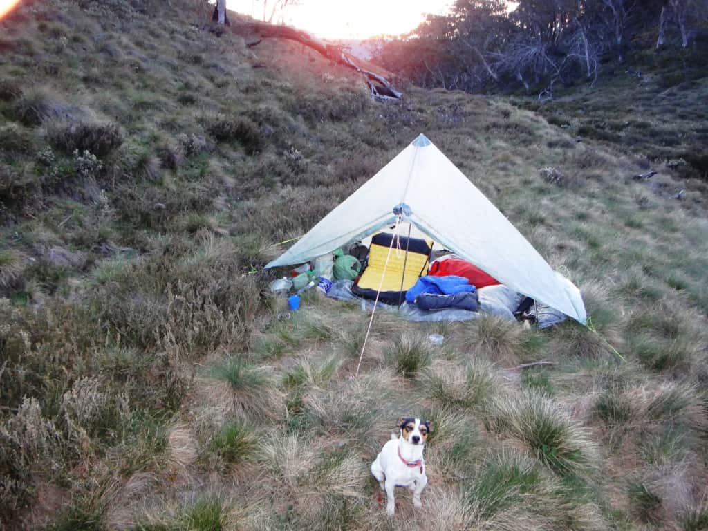
The satellite imagery showed that the most recent fire (a couple of years ago) had cleared the eastern side of the old road from there out towards Mt Darling so I really expected that if I got that far I should be able to check whether there really is or can be a water source in the vicinity of the (two) saddles adjacent to Mt Billabong. But…”The best laid plans of mice and men”. There are further Snow Grass Plains up that way which could form a sort of private hunting preserve.
I have thought also that the ridge which runs down from Mt Darling to the junction of Mt Darling Creek and the Wonnangatta should be easy enough to walk – likewise the Daimantina Spur which runs from that junction up to the Snowy Plain (above). It seems also plausible one could drop down a ridge to the Carey Creek below where there is also a good camp (and hunting). Years ago (when there were cattle) you used to be able to walk up the Mt Darling Creek easily for miles. I walked up it about three kilometres last year. It was not bad going – and there were many excellent campsites along there with water.
I like to move along. It would be splendid to be able to hike/hunt for a day then camp (with water) then do the same the next day (and so on), perhaps starting at the Wonnangatta- Moroka confluence or from the end of the Moroka Creek Track – and bearing in mind that you had a warm dry hut (with a fire) somewhere in the middle of it all to dry out your clothes, take a break etc. Maybe an adventure for others now.
The snow gums (particularly) are all being killed by Parks’ mismanagement and I no longer think that the idea of a ‘Wilderness Area’ is a sensible one. It will only lead to the near total destruction of this wonderful bush area/type. When we had a logging industry which encompassed all of our bushland as well as mountain cattle helping to keep the bush clear and free of awful destructive fires, you could pretty much walk through any of our bush at around 4 km per hour – even ride a horse most places. Now I can’t even force my way through the regrowth on a road I walked just a couple of years ago at any more than 1/2 a km per hour. I spent 2/1/2 hours walking the kilometre onwards from the Mt Darling Saddle to where I turned back! Take more water with you than I did.
I wrote about the deaths of the snow gums during our walk out to Feathertop back in autumn.
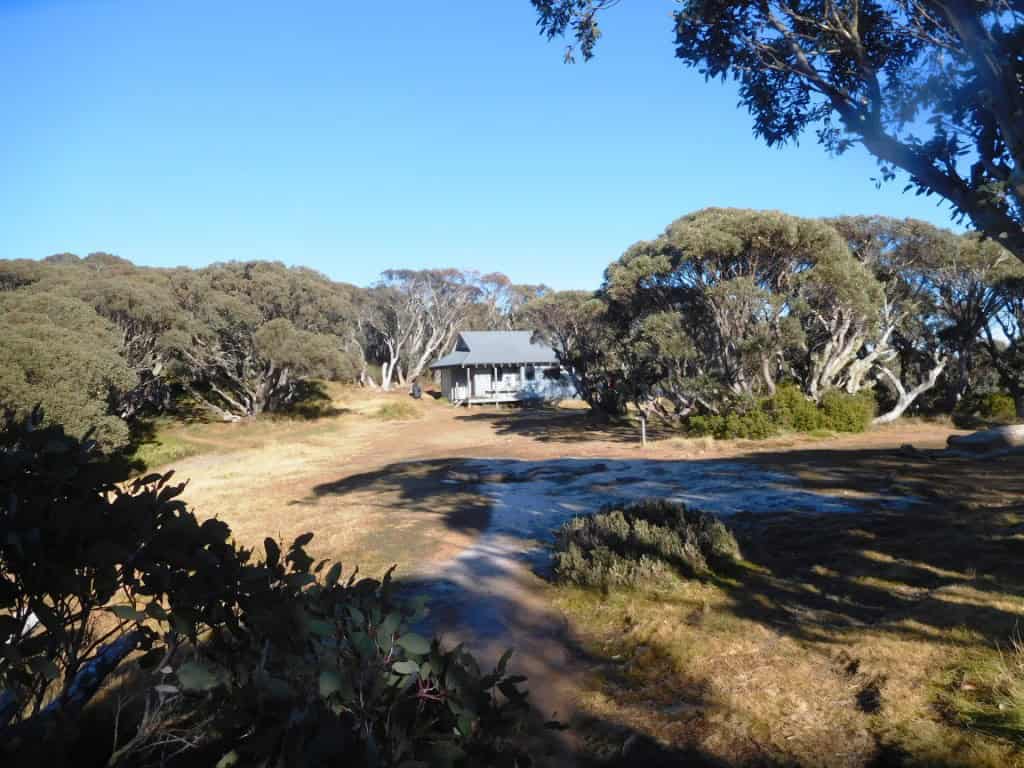
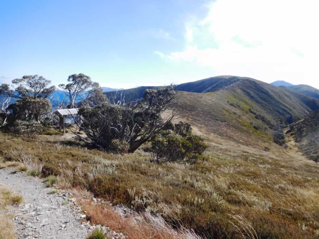
Before we started having these awfully destructive (really hot) summer fires the snowgums looked pretty much as you see them around the Federation Hut in the photo. or as they are still along the Baw Baws (as on our Birthday Walk – last year, below). It has taken them since 1939 to get this big though.
But now they are like this all the way along the Howitt Plains Road- just waiting for the next inferno to obliterate them. Countless square kilometres of them!

There are tens (probably hundreds) of thousands of hectares just like this or just obliterated altogether like this (as they were all the way out to Feathertop – what used to be snow-gum forest like the Baw Baws is still). You can see how the dreadfully hot fire has completely cleared and eliminated the forest all the way down to the valley below. Mountains which used to be wreathed in forest for aeons are now bare, in some places the very soil has been baked and washed away down to bare rock.
I don’t know whether the snow gum forests can be saved at all. About 80% of them have been killed/burned in the last 10-20 years. Those which have been burned are filled with dead timber and coppiced regrowth which will not survive another fire though such a return fire is inevitable given the fuel load and the surrounding snow grass – uneaten by stock. Parks even aerial culls deer to prevent them eating it. No worse ‘management ‘ can be envisaged.
Massive efforts to mechanically collect the dead wood into piles, burn it there (carefully) then cool burn the remaining fuel load would have to be undertaken if we wanted to save some. Lots of fire breaks. Summer stock grazing would have to be reintroduced and annual cool burning to prevent such a situation reoccurring. It is all (politically) and logistically implausibe. I think the snow gum forests are gone. Sadly. And all the creatures and plants which used to inhabit them. On the way out to Feathertop and back I saw only five living things: two ants, a spider and a solitary pair of migratory birds enjoying a stopover – and a few scraps of skin from helicopter-shot deer!
I think it is still possible to save some of the other forests, but the fuel load is just so huge as to make this an immensely daunting task which I doubt the government will undertake. Too many bureaucrats and not enough workers. We must winter burn whatever will burn and we will need to create huge fire breaks so sections can be burned off independently of each other. Otherwise we will just have vast conflagrations (millions of acres at a time) which will simply kill everything.
We also urgently need to return to being able to log the entire area over a long rotational period. It is anyway ridiculous not to use a valuable resource but only to burn and destroy it. An autumn fuel reduction burn should just creep along no faster than a lizard can walk leaving the greener areas unburned. It is also important to be able to use stock (cattle, sheep etc) to reduce the annual growth of edible (and flammable) grasses before the danger of the summer fire season’s beginning.
I have already seen the results of these mega-fires. For example, Della and I walked along the Moroka and Wonnangatta after the 2009 fires and saw four birds in total in an area where the morning and evening (bird) chorus was all-but deafening before. On one (driving) trip at that time through the burned area we traveled over one hundred kilometres without seeing a single sign of a single living thing.
No sane person believes that this is ‘conservation’. We do need to pass the bush on to future generations but we can only do that by using it, by working it and with it, not by locking it up into some magical ‘Wilderness Area’ or ‘National Park’.
The sign actually says ‘Management Vehicles’ and “Walkers Only’.

The Carey Road: as I said, a couple of young fellows could clear a cycle path out as far as the Mt Darling Saddle in a couple of days towing a bicycle trailer behind them. It is getting too much for me at 75. Time to ‘pass the baton’ I’m afraid.


See Also: Nuts to ‘Leave No Trace’

Thanks for another report from the forest’s heart. Your concept of a nation-building project to manage our forests and wildest areas free from the sclerotic and irrelevant burnt out shell of our national parks governance would be of incalculable value over five, ten fifty years just for a start.
Add a Bradfield diversion of water to the Murray Darling system and what a sparkling market garden behemoth would our land provide.
If he has time Elon Musk could devise a template to get it going, sack nine tenths of the office workers, though it’d be a skirmish.
Great to see the dogs along as always even if the NP lot get indigestion. Merry Christmas to you all, thanks for the info and the smiles.
Thank you Greg. Your Bradfield suggestion is also welcome. I suspect also any trees we are now growing are the wrong ones being mainly gums and wattles which I doubt increase rainfall or soil moisture. Willows, oaks etc would do a better job. It would be great to have the road out to Mt Darling navigable. There is a wonderful view from the top (which I will probably never see again (Check it on Google Earth). Cheers, Steve. PS Perhaps you will be joining my working group?