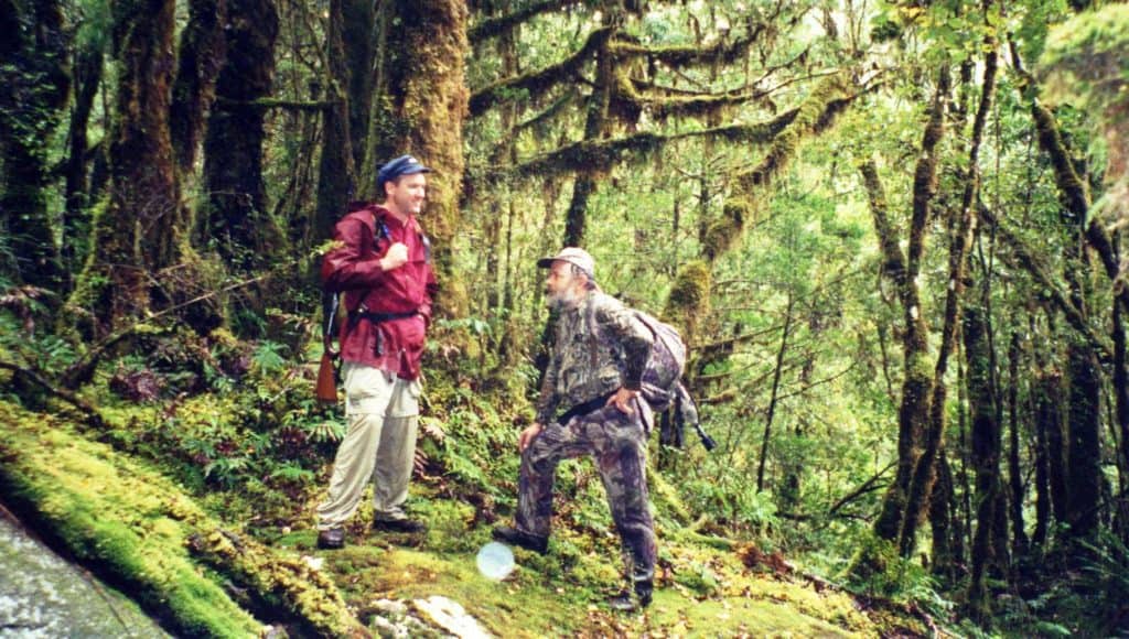
Last week my friend, Brett proposed we walk out to Federation Hut and Mt Feathertop for an overnight trip. Though I had a bad cold and was not feeling very fit I jumped at the chance. There is just so much work to get done around the farm – I may be avoiding some of it really.
Brett has produced a fine video of the trip which should give you a better idea of what it was like than my few photos. Watch it here: The Razorback
We were at least promised two days of fine weather with daytime temperatures (at Mt Hotham) of 7 to 10C and overnight around 0C (probably a tad cooler at Federation Hut – at the base of Mt Feathertop) because it is a little higher and maybe more exposed.
As it turned out I think the first day was colder than that and the next warmer, but the night was definitely below zero because there was 1/4″ (at least) of frost on the (frozen) ground until after 10:00am next morning. Very slippery – nearly needed those Ultralight Crampons. We were there on May 6 & 7.
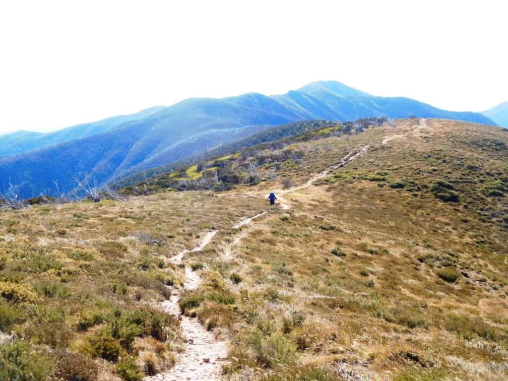
The walk out to Federation/Feathertop is 10-12km largely just on or off the side of a ridge which undulates quite a bit but rises very steeply (approx 250 metres) in the last <1km if you decide to ascend the mountain (I didn’t).
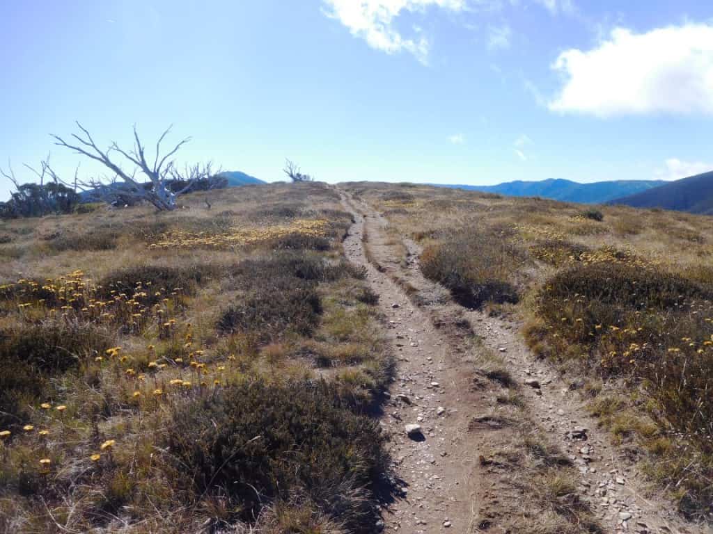
The surface is generally very good – a well-formed track and hard-packed gravel or rock. It is probably around 25,000 steps each way to the hut (about the same as our recent walk from Echo Point to Cynthia Bay) but quite a bit of change in elevation, so about 3-5 hours depending on your age and how much you hurry.
Some (younger) folk go there and back in a day. Not so long ago I could have too but I have not entirely recovered my fitness from two months of pneumonia from our November foray towards Everest so taking two days was quite enough effort for me at the moment.
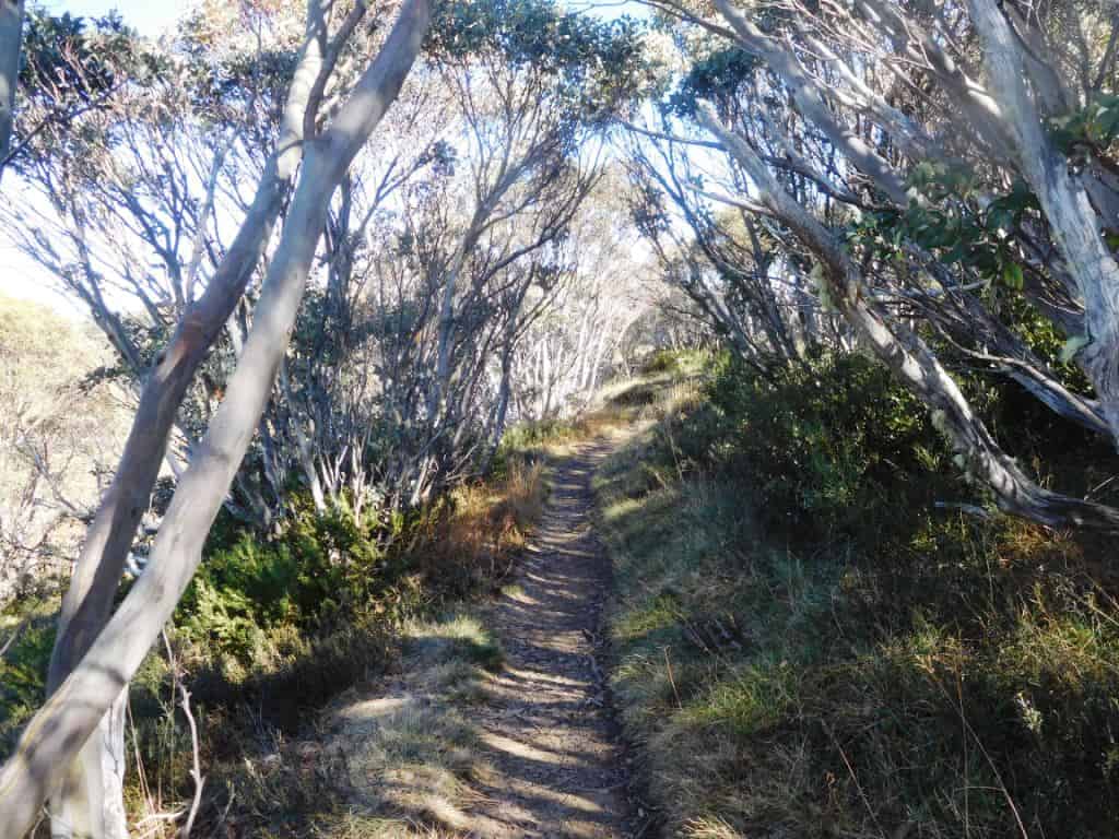
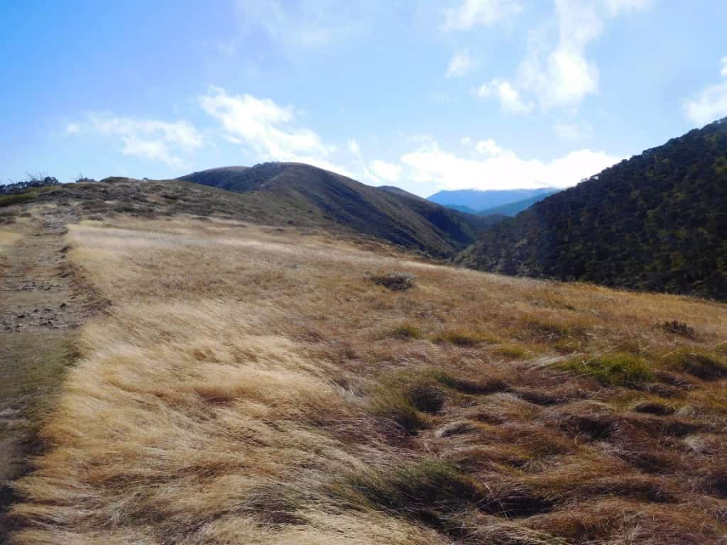
Not so long ago (<ten years) before the disastrous fires which are consequent on declaring areas National Parks it seems to me, the walk would have been very different. Much like what walking along the Baw Baws still is today I guess, as they are/were both alpine snow-gum ‘forest’ but while that forest (still) encloses (and shelters) you along the Baw Baws it has been just about completely razed along the ridge out to Feathertop so that if it is windy and very chilly indeed.
See Upper Yarra Track Instructions for walks along the Baw Baws and further afield.
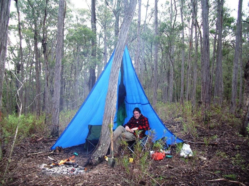
Here is one of my night camps a few year’s ago slung across the Upper Yarra Track on the top of the Baw Baws for comparison. These snow gums would have been killed by the 1939 fires and have taken this long to recover:

Whitelaws Hut campsite on the Baw Baws

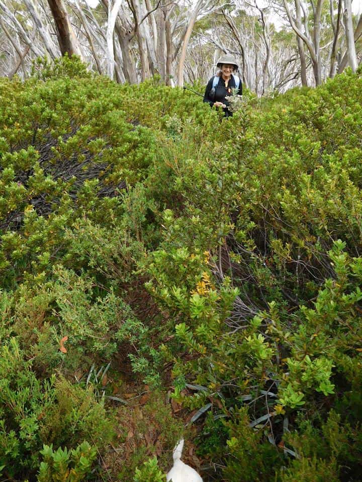
Healthy unburnt snow-gum forest along the Baw Baws
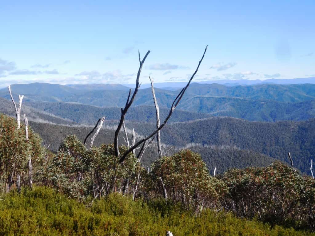
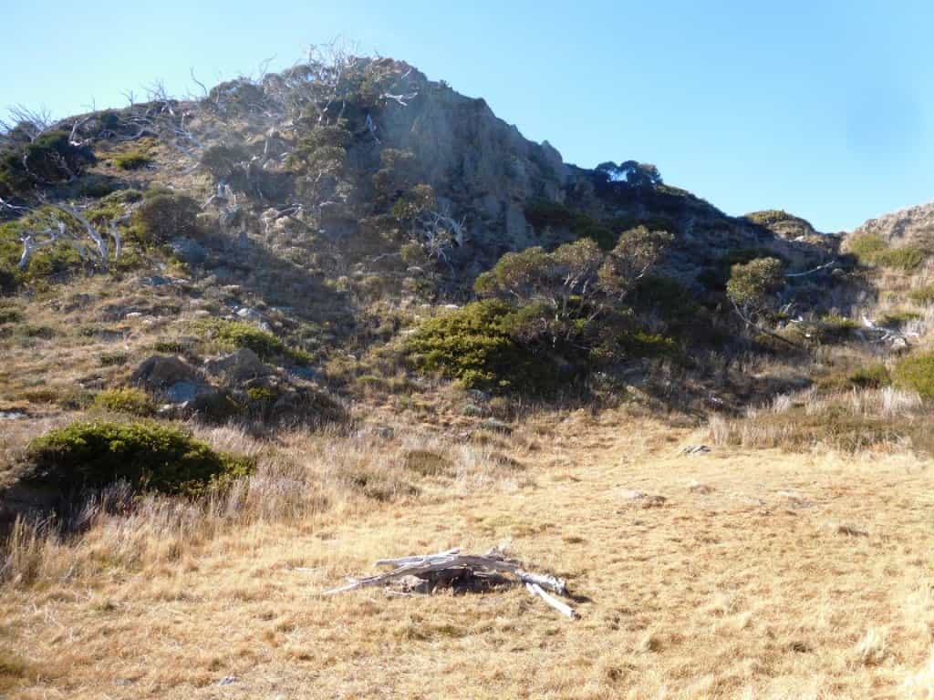
Indeed what you are seeing on the Feathertop walk is dead snow-gums for about as far as the eye can see. Anyway for many, many miles in every direction. A dreadful tragedy really. Near the top of the ridge the trees have almost always been obliterated utterly as if they had never been. Sometimes there are dead stumps.
Like this:
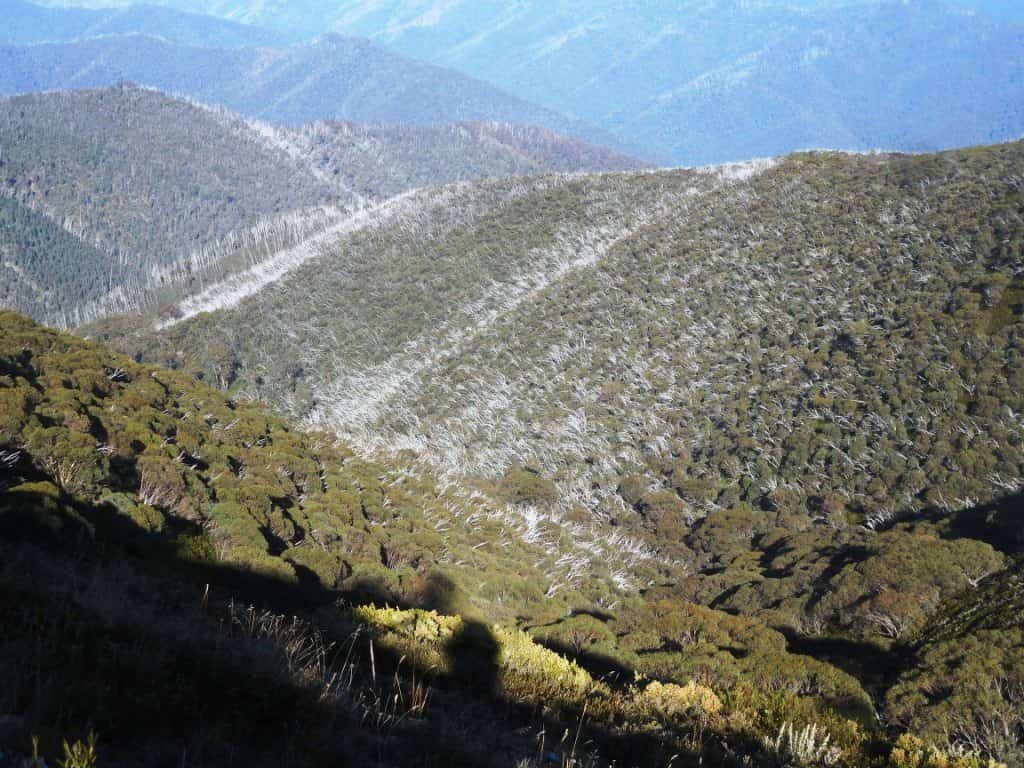
Further down the ridges and often all the way to the valleys far below every tree top has been fire killed and stands there quite dead today but the roots have usually shot away in multiple trunks (much like coppicing).
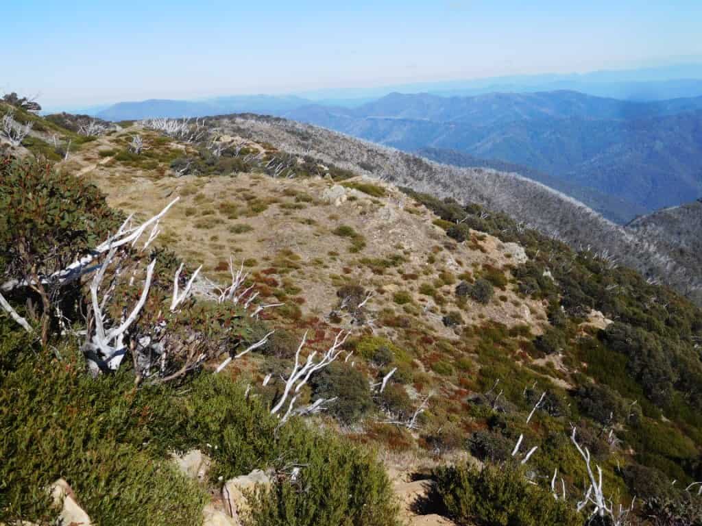
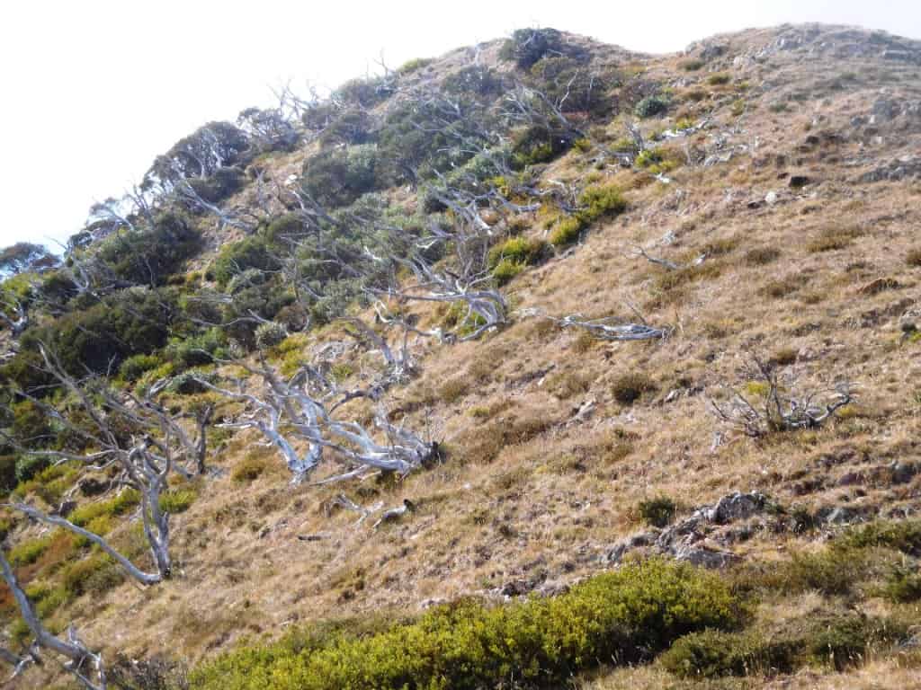
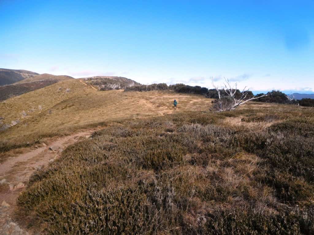
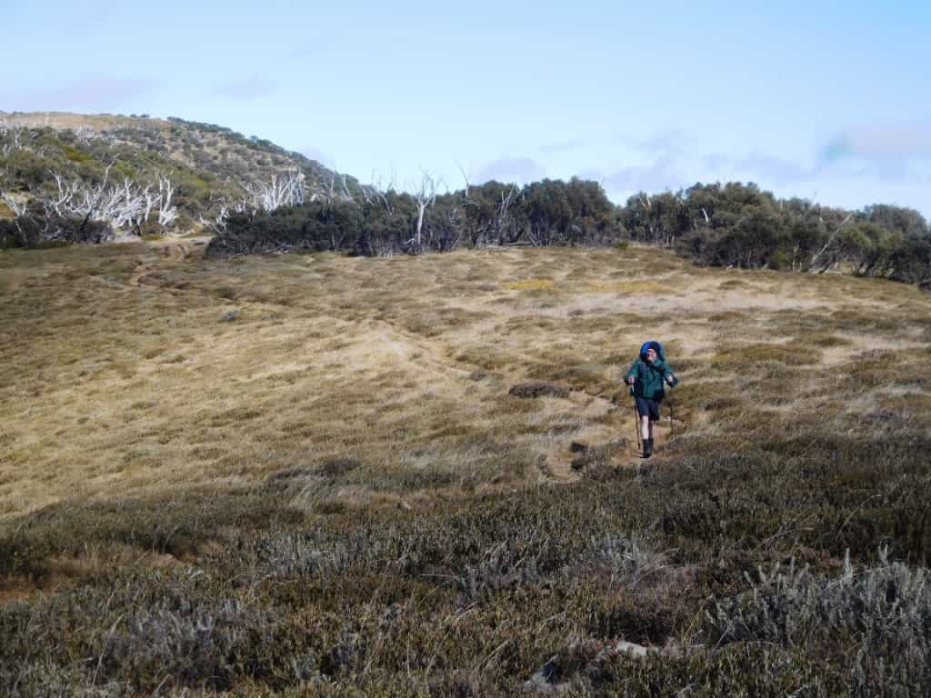
I’m sure you had already spotted how bare the ridge is in Brett’s video (above) but there are some of my photos to emphasize the point:
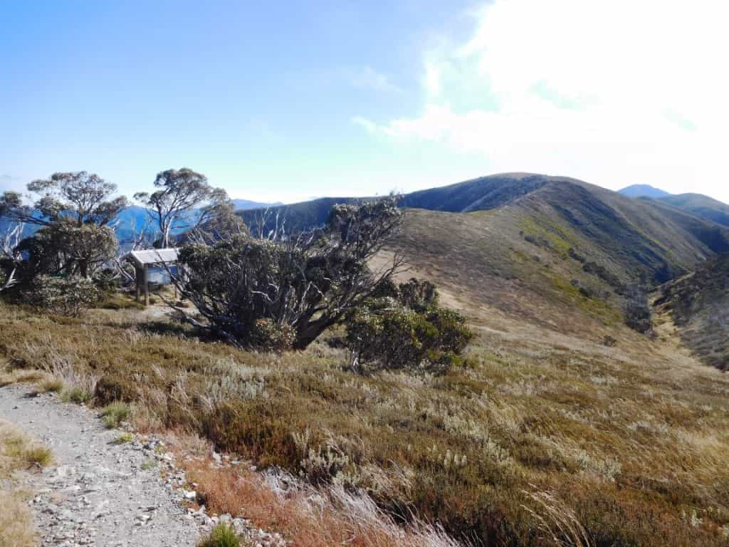
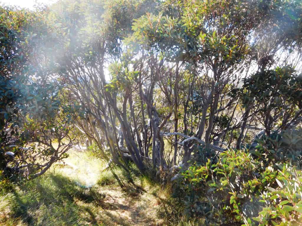
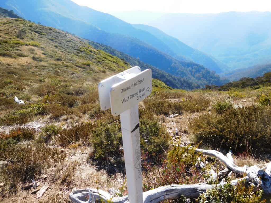
For contrast, this was (practically the only ‘untouched’ spot along the Feathertop Ridge in 12 km.
Starting out from Hotham (Diamantina Hut). The roof in the foreground is the check-in ‘station where it would have been so easy for Parks to have left a notice saying there was no water at Federation Hut. Fortunately we knew there was a spring about 1 1/2 km away from the hut!
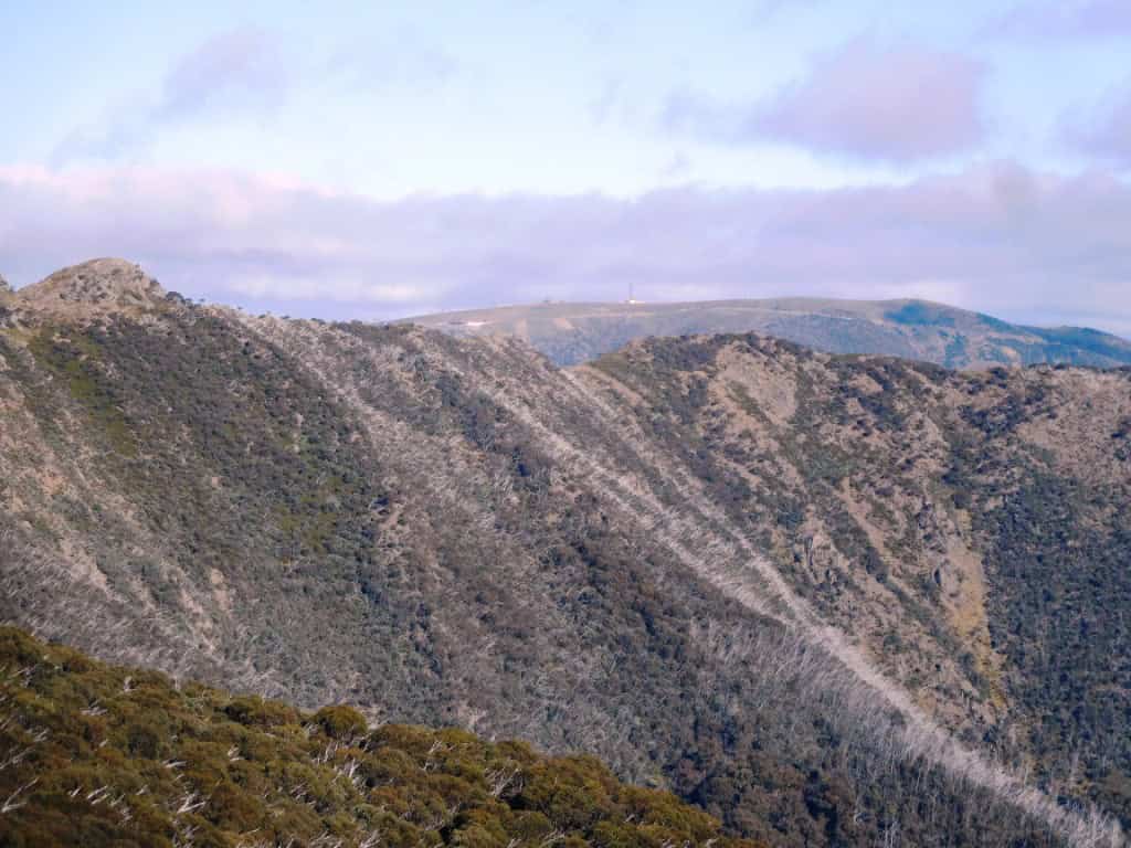
About a km in looking back towards Hotham
The snow gums have been coppiced by the fire.
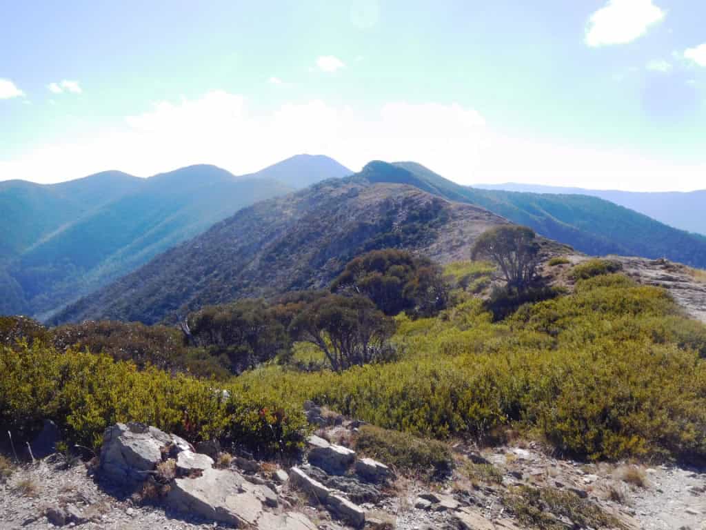
Some of that fuel that cattle would have consumed. Looking towards Feathertop. A long ridge.
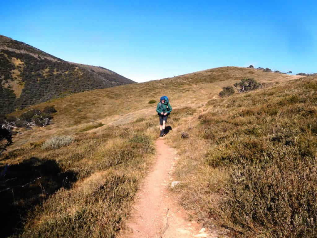
A couple of km in looking towards Hotham
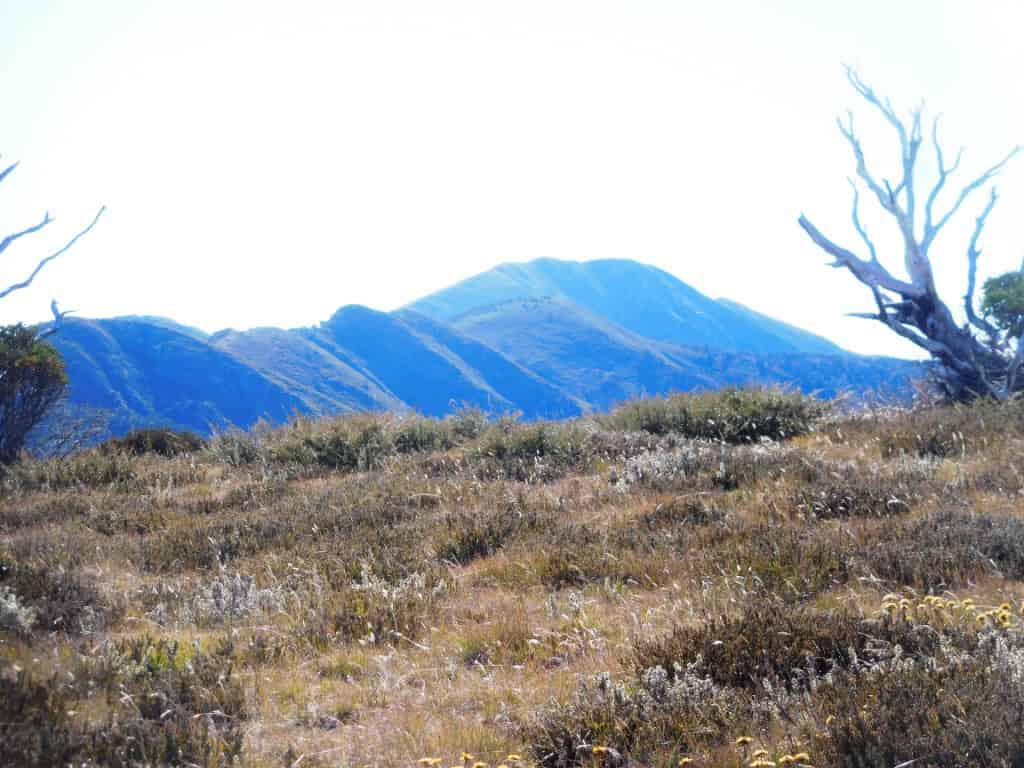
And towards Feathertop
There would have been some pretty wildflowers earlier in the season.
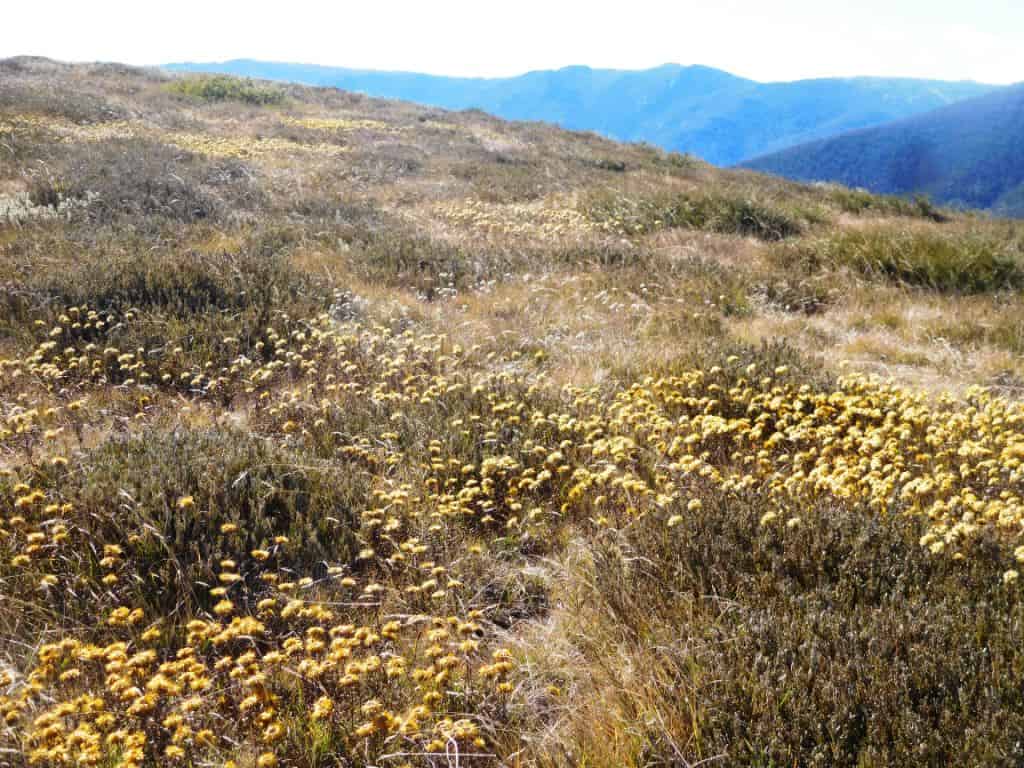
And you can see that not so long ago you would have been walking through snow gum forest.
Looking towards Feathertop
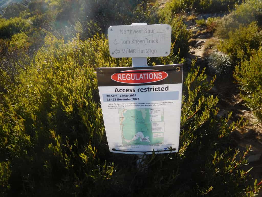
The track is well signposted with new (metal) signs at intersections:
And explanations about their bizarre deer ‘management’.
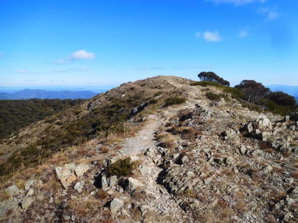
Not quite on top of the world, but this (the grand views) is the major feature of track walking.
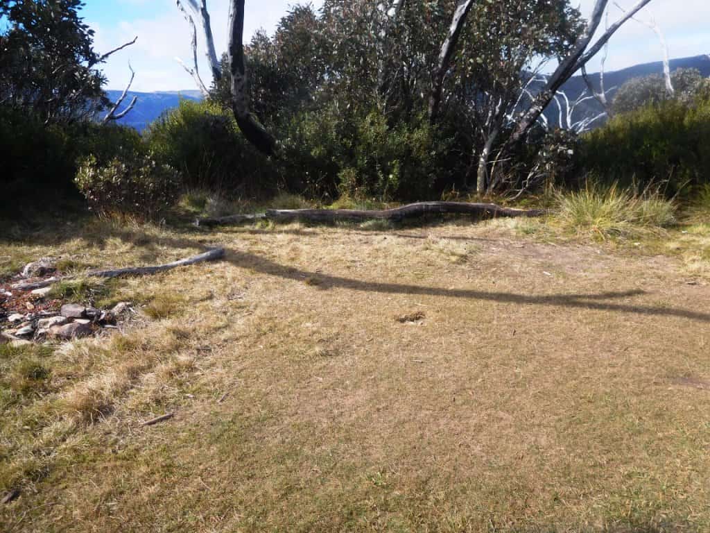
There are (sheltered) spots to camp along the way (but no water) a deficiency which could be easily remedied with a sheet of poly and some work by Parks staff – but don’t hold your breath. People have (wickedly) been having campfires with the well-provided firewood.
Feathertop coming closer
It is a very dry, hard barren ridge much of the way. I suspect much of the soil has been washed away following this extreme fire.
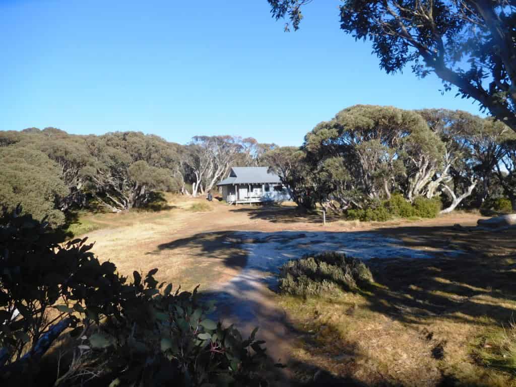
After approx 10 km Federation Hut looms into view on the left. The building on the left is a Parks Vic mega-toilet, no doubt architect-designed. Imagine having to ascend to the first floor to use it. Alas, there is no sign of the original hut after which this one was named.
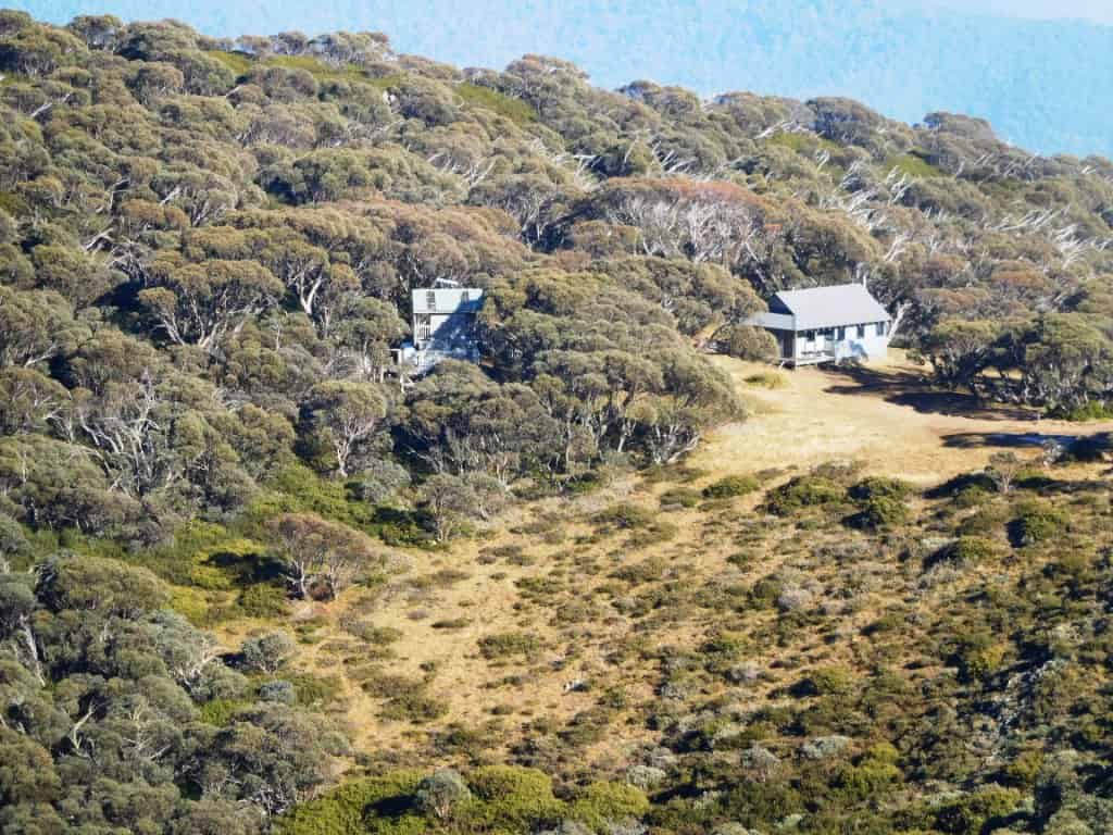
It is a 4 bunk hut but easily big enough to sleep a dozen – however it has clearly only been provided for Parks staff as signs say you ought not camp inside (though we did). There is an excellent pot belly stove but the bow saw has been locked away for Parks use in case people might want to warm themselves on a freezing winter night. You should bring your own 120 gram saw. Perhaps you can see some of that frost.
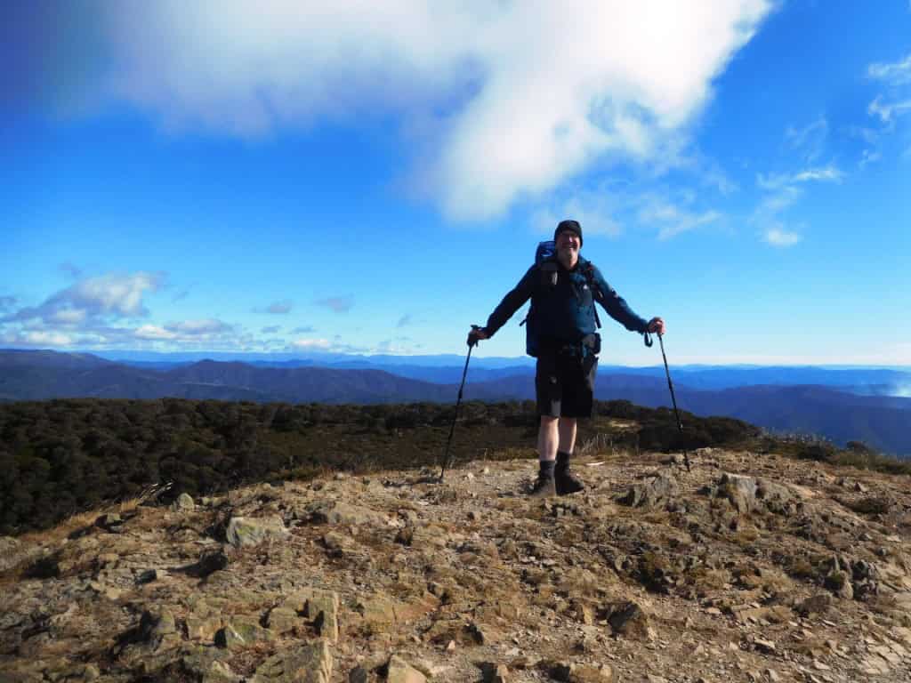
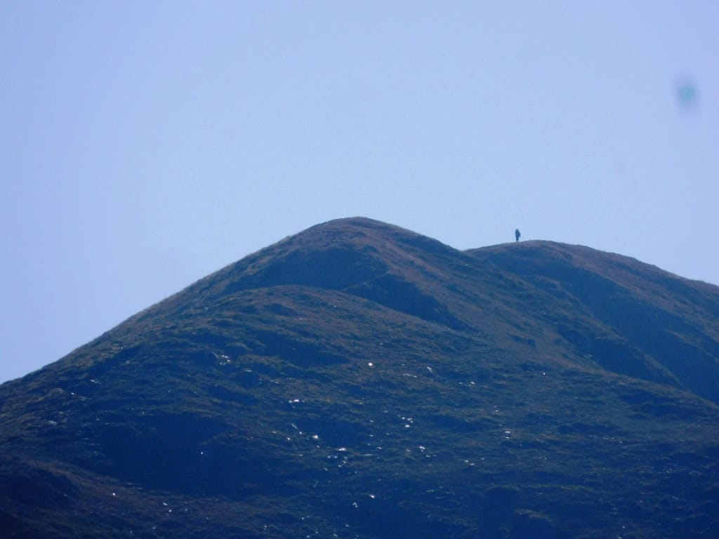
I walked with Brett to the base of the mountain but the 250 metres up and down the ridge in less than 1 km did not look so inviting to me.
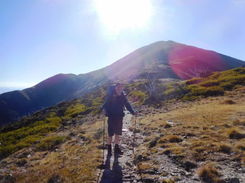
He walked triumphantly right to the top though, as you can see.
The snow gum trees are obviously very slow-growing so that even though this terrible event is a decade in the past the shoots are only about two meters tall and no thicker than your wrist.
Their continued survival is dreadfully dependent on rainfall and the next fire not arriving. Such a proliferation of immature growth needs substantial rainfall but the sheer quantity of dead timber, some still standing some lying next to the shoots (I would estimate many hundreds of tonnes per acre of dry wood) means that the next fire will definitely kill all the roots and create a desperately bare landscape for probably centuries to come.
Without creating many substantial fire-breaks and cool burns I can’t see how this (next) destruction can be avoided. If the cattle and fuel reduction regimes had not been removed and the area had not been made ‘National Parks’ this would never have happened, and could perhaps be prevented from getting worse by returning the cattle (and their land managers) over the summer.
Surprisingly none of the people I met even noticed all the dead trees even though to me it looked rather like ‘The Desolation of Smaug’ from Tolkien’s ‘The Hobbit’. City folks I guess. When it was pointed out to them they simply asked, ‘Oh, Isn’t this just what it was always like?’ even though (on the way there) they had (presumably) driven through some snow gum forest (which was very different) and which hadn’t burned or had been prevented from burning eg between Hotham and Cobungra Station.
There were lots of other hikers. I was frequently passing people on the track and during the night (at Federation Hut) there were three dozen people (on a Monday night!) including ourselves. This is far too much for me – and why I normally do not ever ‘track walk’.
All these people had been deceived by Parks Vic about the availability of water at the hut. The water tank was empty and had been for some time even though their rangers had clearly been there in the past week and had not bothered to post a sign saying that at the sign-in point at the beginning of the track. Very dangerous stuff (but typical). Fortunately the spring a kilometre away at the start of the MMUW Track had water but I expect this was fortuitous.
A lack/shortage of water is the worst aspect of these tracks along the tops which are so common. Perhaps you can see why I (usually) prefer to Gully Walk and Make My Own Routes, or see Wonnangatta Pack (Raft) Track for example.
You would hope that some ‘everlasting’ tanks could be cheaply and easily constructed by Parks’ innumerable staff something like this idea How To Create Water for Your Camp Site, but don’t hold your breath!
I think the worst aspect of the walk was the almost total absence of animal life. Even after approximately ten years there was not a sign of animal droppings or tracks and almost no resident birds. The type of birds which like to live in this heath/snowgum country (and which are innumerable at my house or along the Baw Baws) are just completely absent – as is any morning or evening chorus up/down the valleys. A dreadful silence.
Literally billions of animals are completely erased by these terrible mega-fires which are just the result of misplaced ‘conservation’ and ‘National Parks’ mentality/mismanagement of the land. Particularly the refusal to reduce fuel loads or provide/maintain fire breaks. See Nuts to leave No Trace for more thoughts on this.
Practically the only evidence of animal ‘life’ were the odd scraps of deer hide dropped by dingoes after the deer had been helicopter shot/poisoned along the forest edge below. In the absence of summer grazing by cattle at least the deer would have been doing something to reduce the fuel load along the top. Their wilful mass-murder (where hunting is banned(!) is yet another example of how Parks has no idea how to manage our public lands.
However I did enjoy the two days spent with Brett after too long an absence together. Sometimes it is good to have fine company in the wilds. I really appreciate his doing all the driving. I admit I find it difficult at my age driving myself for 4-5 hours, then walking for a further 4-5 to some remote camp spot, but I am still doing it whenever I have the opportunity. I hope to be off with him again soon.
Here is a photo of him enjoying one of my poly shelters years ago (in an unburnt forest near Ensay we passed on the way to Feathertop) – from the post How to Have Fun When Hiking in the Rain:
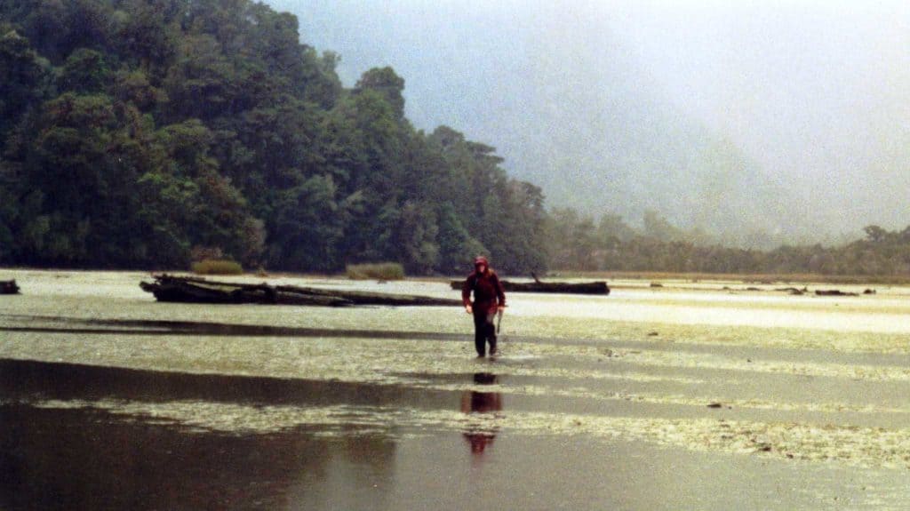
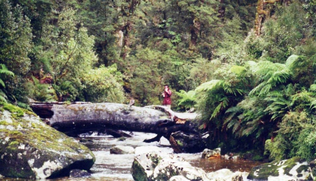
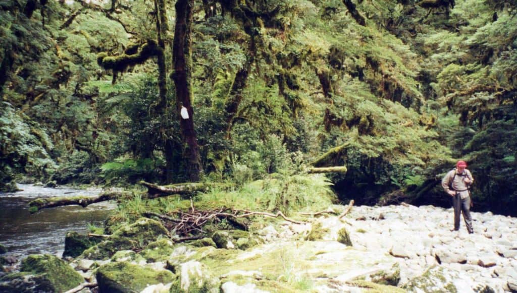
Here are a couple of photos of him helping me hunt moose in Fiordland 25 years ago. See. See Lure of the Moose
Thanks for the travel logue. I dont know much about the area but of course remember.thr catastrophic fires. I am surrounded by Wollemi Park. The issues you raise about fuel loads are the same here I am afraid. Behind me on the western edge thete has been attempts to reduce fuel loads which have never been successful.
These areas should never have been made National Parks if they cannot be managed. Whatever fuel will burn needs to be burned at least once a year. In the case of snow gums they are just completely destroyed by these fires and will not reappear (along with whatever lived in them).
Hello Steve,
enjoyed reading this account you guys trekking – plus the early pics (haven’t viewed video yet). I’ve done that walk a couple of times in the 1980’s; your speculation about the trail once being like “…forest (still) encloses (and shelters)” – it was definitely like that, because I remember my strongest impression just about was “I really wish there were more views – it’s so thickly treed and vegetated”. Also, you’re not meant to actually camp in nice new Federation Hut – just look at it? How bonkers is that!
Good reading on a damp Sunday arvo anyway – thanks…!
Alan.
Thanks Alan, I am so glad to have confirmation of this important fact. The National Park ‘solution’ is something like Lt Calley’s ‘solution’ at My Lai, ie having to destroy it in order to save it! The sooner these awful policies can be reversed the better it will be for the bush. Cheers, Steve.
Hi Steve, Great to meet you up at Federation Hut, we had a great time chatting with you. I’ve enjoyed reading through some of your articles on here since!
Cheers, Braiden
Thank you. We enjoyed meeting you and Bella too Braiden. We hope you drop in when you are in the neighbourhood. We live near Churchill in Gippsland which is within striking distance of many interesting places. Cheers, Steve & Della.