(Updated) Rainfall at Mt Hotham is a pretty good analogue for river flow on the Wonnangatta-Mitchell. The river flows at approx 4km/hr. Use that fact to time the canoeability of sections.
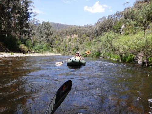
For example, on Monday (9 Jan) it rained steadily all afternoon and there was 63 mm of rainfall at Mt Hotham by the time it stopped around 9pm. The whole valley got a good soaking. You can check this is happening by comparing eg rainfall at Dargo. You can see that it is raining by checking the radar. I use http://ozforecast.com.au/cgi-bin/weather.cgi?station=Mt+Hotham.VIC&radar
By 2.52am on the 10th the river had started rising at Waterford (from a low of 1.72metres). By 14.22pm it had reached 1.80 metres which is the recommended canoeable height for the section downstream of Waterford (& indeed all the way from the Humffray). I would be fairly confident of setting out from the Kingwell Bridge at 1.75 metres height as measured at Waterford with a flow like this coming down behind me.
It rose to 1.84 metres at 21:17pm on the 10th, stayed there until 8: 52am on the 11th and then began falling. By 19:17 on the 11th the river had returned to 1.80 at Waterford. So, the river remained canoeable for 29 hours. (Update: I now know the river is canoeable at 1.75, and probably at 1.70!)
NB: On AdventurePro’s website they claim the river is canoeable downstream from Angusvale at .6 metre on the Glenaladale gauge: https://www.adventurepro.com.au/paddleaustralia/pa.cgi?action=details&id=mitchell This would probably work out at less than 1.5 metres on the Waterford gauge! They claim the same height for the section Waterford to Angusvale: https://www.adventurepro.com.au/paddleaustralia/pa.cgi?action=details&id=Mitchell1
Since the bushfires summer flows have been deplorably low and will likely remain that way for many years. You have to catch the wave! If you started out from Waterford before 19:17 on the 11th you would ride that wave all the way to Glenaladale (except you would have to sleep!)
If you anticipated the wave you would be able to start at Waterford on the morning of the 10th and still have two days of beautiful canoeing down to Angusvale. There is going to be 12-20mm of rain again at Hotham on Friday 13th. The rain is going to come in about midday and continue until after midnight.
Saturday and Sunday the river should be canoeable anywhere from Eaglevale down and the weather should be fine and about 26C. This should be a good weekend on the Wonnangatta. Enjoy!
NB: A follow up on this post appears below the data:
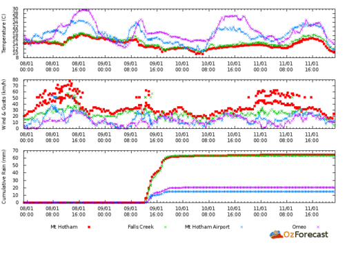
Mt Hotham Rainfall Totals:
| Tue 00:00 EDT | N | 31 | 41 | 12.3 | – | 9.5 | – | – | 62.6 | 0.0 | – |
| Mon 23:50 EDT | N | 31 | 35 | 12.2 | – | 9.3 | – | – | 62.6 | – | – |
| Mon 23:40 EDT | N | 31 | 35 | 12.2 | – | 9.3 | – | – | 62.6 | – | – |
| Mon 23:30 EDT | N | 35 | 43 | 12.4 | – | 9.4 | – | – | 62.6 | 0.0 | – |
| Mon 23:20 EDT | N | 33 | 37 | 12.4 | – | 9.5 | – | – | 62.6 | – | – |
| Mon 23:10 EDT | N | 39 | 44 | 12.4 | – | 9.2 | – | – | 62.4 | – | – |
| Mon 23:00 EDT | N | 35 | 44 | 12.4 | – | 9.4 | – | – | 62.4 | 0.0 | – |
| Mon 22:50 EDT | N | 33 | 37 | 12.4 | – | 9.5 | – | – | 62.4 | – | – |
| Mon 22:40 EDT | N | 39 | 44 | 12.4 | – | 9.2 | – | – | 62.4 | – | – |
| Mon 22:30 EDT | N | 35 | 46 | 12.3 | – | 9.3 | – | – | 62.2 | 0.0 | – |
| Mon 22:20 EDT | N | 28 | 31 | 12.2 | – | 9.6 | – | – | 62.2 | – | – |
| Mon 22:10 EDT | N | 33 | 41 | 12.1 | – | 9.1 | – | – | 62.2 | – | – |
| Mon 22:00 EDT | N | 28 | 39 | 12.1 | – | 9.4 | – | – | 62.2 | 0.0 | – |
| Mon 21:50 EDT | N | 37 | 43 | 11.9 | – | 8.7 | – | – | 62.2 | – | – |
| Mon 21:40 EDT | – | 33 | 35 | 12.0 | – | 9.0 | – | – | 62.0 | – | – |
| Mon 21:30 EDT | NNW | 31 | 39 | 12.0 | – | 9.1 | – | – | 62.0 | 0.0 | – |
| Mon 21:24 EDT | N | 31 | 50 | 12.1 | – | 9.2 | – | – | 62.0 | 0.0 | – |
| Mon 21:20 EDT | N | 28 | 30 | 12.0 | – | 9.3 | – | – | 62.0 | – | – |
| Mon 21:10 EDT | N | 37 | 41 | 12.0 | – | 8.8 | – | – | 62.0 | – | – |
| Mon 21:00 EDT | N | 30 | 37 | 12.1 | – | 9.3 | – | – | 61.8 | 0.0 | – |
| Mon 20:50 EDT | N | 20 | 30 | 12.1 | – | 10.0 | – | – | 61.8 | – | – |
| Mon 20:40 EDT | NNE | 33 | 39 | 12.0 | – | 9.0 | – | – | 61.8 | – | – |
| Mon 20:30 EDT | NNW | 26 | 37 | 12.1 | – | 9.6 | – | – | 61.8 | 0.0 | – |
| Mon 20:20 EDT | N | 31 | 41 | 12.0 | – | 9.1 | – | – | 61.8 | – | – |
| Mon 20:10 EDT | N | 35 | 39 | 12.0 | – | 8.9 | – | – | 61.6 | – | – |
| Mon 20:00 EDT | N | 28 | 33 | 11.9 | – | 9.2 | – | – | 61.4 | 0.0 | – |
| Mon 19:50 EDT | N | 22 | 26 | 11.9 | – | 9.6 | – | – | 61.4 | – | – |
| Mon 19:40 EDT | NNW | 17 | 22 | 11.6 | – | 9.7 | – | – | 61.2 | – | – |
| Mon 19:30 EDT | N | 24 | 30 | 11.8 | – | 9.3 | – | – | 61.0 | 0.2 | – |
| Mon 19:20 EDT | NNW | 22 | 24 | 11.8 | – | 9.5 | – | – | 60.8 | – | – |
| Mon 19:10 EDT | N | 26 | 30 | 11.8 | – | 9.2 | – | – | 60.6 | – | – |
| Mon 19:00 EDT | NNW | 24 | 33 | 11.7 | – | 9.2 | – | – | 60.0 | 0.6 | – |
| Mon 18:50 EDT | NNW | 22 | 28 | 11.4 | – | 9.0 | – | – | 59.6 | – | – |
| Mon 18:40 EDT | NW | 24 | 28 | 11.0 | – | 8.3 | – | – | 59.2 | – | – |
| Mon 18:30 EDT | NNW | 22 | 35 | 11.1 | – | 8.6 | – | – | 58.8 | 0.4 | – |
| Mon 18:20 EDT | NW | 22 | 24 | 11.4 | – | 9.0 | – | – | 58.6 | – | – |
| Mon 18:10 EDT | NW | 28 | 31 | 11.6 | – | 8.8 | – | – | 57.8 | – | – |
| Mon 18:00 EDT | NW | 26 | 33 | 11.7 | – | 9.1 | – | – | 56.8 | 0.4 | – |
| Mon 17:50 EDT | W | 28 | 33 | 11.4 | – | 8.5 | – | – | 56.4 | – | – |
| Mon 17:40 EDT | W | 30 | 35 | 11.0 | – | 7.9 | – | – | 55.8 | – | – |
| Mon 17:30 EDT | W | 28 | 41 | 10.7 | – | 7.6 | – | – | 54.8 | 1.6 | – |
| Mon 17:20 EDT | W | 35 | 39 | 10.4 | – | 6.8 | – | – | 53.4 | – | – |
| Mon 17:10 EDT | W | 39 | 44 | 11.1 | – | 7.5 | – | – | 50.6 | – | – |
| Mon 17:00 EDT | NNW | 22 | 31 | 12.0 | – | 9.7 | – | – | 46.2 | 2.6 | – |
| Mon 16:50 EDT | N | 22 | 28 | 12.2 | – | 10.0 | – | – | 44.0 | – | – |
| Mon 16:40 EDT | N | 28 | 35 | 12.4 | – | 9.8 | – | – | 43.0 | – | – |
| Mon 16:30 EDT | NNW | 28 | 39 | 12.7 | – | 10.2 | – | – | 42.6 | 0.4 | – |
| Mon 16:20 EDT | NW | 31 | 35 | 12.6 | – | 9.8 | – | – | 42.2 | – | – |
| Mon 16:10 EDT | NW | 26 | 30 | 12.8 | – | 10.5 | – | – | 41.6 | – | – |
| Mon 16:00 EDT | NW | 28 | 43 | 12.6 | – | 10.1 | – | – | 41.4 | 0.6 | – |
| Mon 15:50 EDT | NW | 28 | 35 | 12.7 | – | 10.2 | – | – | 40.8 | – | – |
| Mon 15:40 EDT | NNW | 24 | 28 | 12.6 | – | 10.3 | – | – | 40.6 | – | – |
| Mon 15:30 EDT | NW | 26 | 39 | 12.4 | – | 10.0 | – | – | 39.6 | 0.4 | – |
| Mon 15:20 EDT | WSW | 17 | 20 | 12.9 | – | 11.3 | – | – | 39.2 | – | – |
| Mon 15:10 EDT | NNW | 20 | 24 | 12.9 | – | 11.0 | – | – | 38.6 | – | – |
| Mon 15:00 EDT | NW | 28 | 44 | 12.8 | – | 10.4 | – | – | 37.6 | 0.2 | – |
| Mon 14:50 EDT | NNW | 20 | 28 | 12.8 | – | 10.9 | – | – | 37.4 | – | – |
| Mon 14:40 EDT | NNW | 30 | 35 | 12.9 | – | 10.3 | – | – | 36.4 | – | – |
| Mon 14:30 EDT | NW | 31 | 43 | 12.9 | – | 10.3 | – | – | 34.8 | 0.4 | – |
| Mon 14:20 EDT | NW | 28 | 41 | 12.9 | – | 10.5 | – | – | 34.4 | – | – |
| Mon 14:10 EDT | NW | 35 | 43 | 12.9 | – | 10.1 | – | – | 31.6 | – | – |
| Mon 14:00 EDT | NW | 33 | 44 | 13.0 | – | 10.3 | – | – | 29.0 | 3.8 | – |
| Mon 13:50 EDT | NW | 33 | 41 | 13.0 | – | 10.3 | – | – | 25.6 | – | – |
| Mon 13:40 EDT | N | 35 | 44 | 13.1 | – | 10.3 | – | – | 22.8 | – | – |
| Mon 13:30 EDT | N | 39 | 61 | 13.1 | – | 10.2 | – | – | 20.0 | 1.4 | – |
| Mon 13:25 EDT | N | 35 | 56 | 13.0 | – | 10.2 | – | – | 19.2 | 1.8 | – |
| Mon 13:20 EDT | NNW | 37 | 46 | 13.0 | – | 10.1 | – | – | 18.8 | – | – |
| Mon 13:10 EDT | N | 19 | 24 | 13.0 | – | 11.2 | – | – | 16.0 | – | – |
| Mon 13:00 EDT | N | 39 | 50 | 13.0 | – | 10.0 | – | – | 12.4 | 1.8 | – |
| Mon 12:47 EDT | NNE | 39 | 44 | 12.9 | – | 9.9 | – | – | 10.6 | – | – |
| Mon 12:37 EDT | N | 43 | 63 | 12.8 | – | 9.6 | – | – | 6.4 | 1.6 | – |
| Mon 12:30 EDT | N | 37 | 50 | 12.7 | – | 9.7 | – | – | 5.4 | 2.6 | – |
| Mon 12:20 EDT | NNW | 35 | 41 | 12.6 | – | 9.7 | – | – | 3.4 | – | – |
| Mon 12:00 EDT | N | 31 | 43 | 12.9 | – | 10.3 | – | – | 0.2 | 0.2 | – |
| Mon 11:50 EDT | N | 33 | 39 | 13.0 | – | 10.3 | – | – | 0.0 | – | – |
| Mon 11:30 EDT | N | 26 | 33 | 13.3 | – | 11.1 | – | – | 0.0 | 0.0 | – |
| Mon 11:20 EDT | – | 26 | 31 | 13.5 | – | 11.4 | – | – | 0.0 | – | – |
| Mon 11:10 EDT | N | 37 | 41 | 13.7 | – | 11.0 | – | – | 0.0 | – | – |
| Mon 11:00 EDT | N | 39 | 48 | 13.9 | – | 11.2 | – | – | 0.0 | 0.0 | – |
| Mon 10:50 EDT | N | 39 | 43 | 13.7 | – | 11.0 | – | – | 0.0 | – | – |
| Mon 10:40 EDT | N | 37 | 43 | 13.6 | – | 10.9 | – | – | 0.0 | – | – |
| Mon 10:34 EDT | N | 33 | 52 | 13.7 | – | 11.2 | – | – | 0.0 | 0.0 | – |
| Mon 10:30 EDT | N | 39 | 52 | 13.8 | – | 11.1 | – | – | 0.0 | 0.0 | – |
| Mon 10:20 EDT | NNW | 35 | 48 | 14.9 | – | 12.7 | – | – | 0.0 | – | – |
| Mon 10:10 EDT | N | 39 | 44 | 15.5 | – | 15.5 | – | – | 0.0 | – | – |
| Mon 10:00 EDT | N | 33 | 44 | 15.3 | – | 15.3 | – | – | 0.0 | 0.0 | – |
| Mon 09:50 EDT | N | 30 | 35 | 15.7 | – | 15.7 | – | – | 0.0 | – | – |
| Mon 09:36 EDT | N | 33 | 52 | 16.0 | – | 16.0 | – | – | 0.0 | 0.0 | – |
| Mon 09:30 EDT | N | 35 | 44 | 16.4 | – | 16.4 | – | – | 0.0 | 0.0 | – |
| Mon 09:20 EDT | N | 33 | 39 | 16.4 | – | 16.4 | – | – | 0.0 | – | – |
| Mon 09:10 EDT | N | 30 | 37 | 16.5 | – | 16.5 | – | – | 0.0 | – | – |
| Mon 09:00 EDT | N | 33 | 44 | 16.1 | – | 16.1 | – | – | 0.0 | 0.0 | – |
Waterford Water Levels:
| Station Date/Time | Water Level (m) |
| 07/01/2017 02:53 | 1.75 |
| 07/01/2017 05:53 | 1.75 |
| 07/01/2017 08:53 | 1.75 |
| 07/01/2017 11:53 | 1.75 |
| 07/01/2017 14:53 | 1.75 |
| 07/01/2017 17:53 | 1.75 |
| 07/01/2017 18:23 | 1.74 |
| 07/01/2017 20:53 | 1.74 |
| 07/01/2017 23:52 | 1.74 |
| 08/01/2017 02:18 | 1.75 |
| 08/01/2017 02:52 | 1.75 |
| 08/01/2017 05:52 | 1.75 |
| 08/01/2017 08:52 | 1.75 |
| 08/01/2017 09:32 | 1.74 |
| 08/01/2017 09:37 | 1.75 |
| 08/01/2017 10:22 | 1.74 |
| 08/01/2017 11:52 | 1.74 |
| 08/01/2017 14:52 | 1.74 |
| 08/01/2017 16:52 | 1.73 |
| 08/01/2017 17:52 | 1.73 |
| 08/01/2017 20:52 | 1.73 |
| 08/01/2017 23:52 | 1.73 |
| 09/01/2017 02:52 | 1.73 |
| 09/01/2017 05:52 | 1.73 |
| 09/01/2017 08:52 | 1.73 |
| 09/01/2017 11:52 | 1.73 |
| 09/01/2017 13:27 | 1.72 |
| 09/01/2017 14:52 | 1.72 |
| 09/01/2017 17:52 | 1.72 |
| 09/01/2017 20:52 | 1.72 |
| 09/01/2017 23:52 | 1.72 |
| 10/01/2017 02:52 | 1.72 |
| 10/01/2017 03:22 | 1.73 |
| 10/01/2017 05:52 | 1.73 |
| 10/01/2017 07:47 | 1.74 |
| 10/01/2017 08:52 | 1.74 |
| 10/01/2017 09:57 | 1.75 |
| 10/01/2017 11:42 | 1.76 |
| 10/01/2017 11:52 | 1.76 |
| 10/01/2017 12:52 | 1.77 |
| 10/01/2017 13:32 | 1.78 |
| 10/01/2017 14:02 | 1.79 |
| 10/01/2017 14:22 | 1.80 |
| 10/01/2017 14:47 | 1.81 |
| 10/01/2017 14:52 | 1.81 |
| 10/01/2017 15:02 | 1.82 |
| 10/01/2017 15:47 | 1.83 |
| 10/01/2017 17:52 | 1.83 |
| 10/01/2017 20:52 | 1.83 |
| 10/01/2017 21:17 | 1.84 |
| 10/01/2017 23:52 | 1.84 |
| 11/01/2017 02:52 | 1.84 |
| 11/01/2017 05:52 | 1.84 |
| 11/01/2017 08:52 | 1.84 |
| 11/01/2017 10:47 | 1.83 |
| 11/01/2017 11:52 | 1.83 |
| 11/01/2017 13:22 | 1.82 |
| 11/01/2017 14:52 | 1.82 |
| 11/01/2017 16:07 | 1.81 |
| 11/01/2017 17:52 | 1.81 |
| 11/01/2017 19:17 | 1.80 |
| 11/01/2017 20:52 | 1.80 |
Ten delightful hours canoeing the beautiful Wonnangatta River from Kingwell Bridge to Waterford Bridge, as ‘we catch the wave’ http://www.theultralighthiker.com/canoeing-the-wonnangatta-catching-the-wave/ (See also: http://www.theultralighthiker.com/pack-rafting-the-wonnangatta-mitchell/) In this section the river journeys for many hours through the most serene and beautiful forest you can imagine – and full of beautiful camping spots! More photos to follow. Here is a foretaste. PS: Delightfully we have found a campsite there where our mobile phones and internet both work!
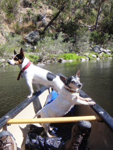
The dogs supervise the proceedings!
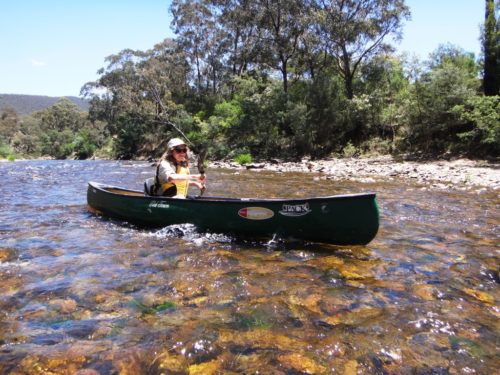
The river is crystal clear!
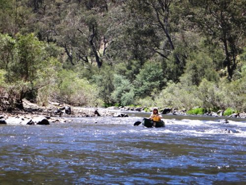
Della is still a slalom champ!
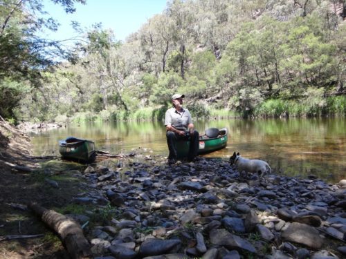
A shady restful lunch stop.
Here are the Waterford gauge readings . We passed the gauge (about an hour above the bridge) late afternoon when it would have read 1.75. This means that this whole section is quite pleasant canoeing at that height. There was nowhere we needed to get out. I believe you could canoe it at 1.70 with a few portages over shallow pebble races but otherwise lots of long, delightful deep sections (See below) . The river had been falling .05 of a metre per day. The rainfall at Mt Hotham (34 mm instead of the predicted .10) returned the river to a canoeable height and put it up a bit. There is more rain predicted (,20) for this Thurs/Fri, so next weekend (20/21 Jan 2017) should also be good canoeing.
See Also:
Section 1: http://www.theultralighthiker.com/wonnangatta-kingwell-bridge-to-black-snake-creek/
Section 2: http://www.theultralighthiker.com/wonnangatta-black-snake-to-hut-creek/
Section 3: http://www.theultralighthiker.com/wonnangatta-hut-creek-to-waterford-bridge/
http://www.theultralighthiker.com/canoe-wonnangatta/
For River Heights: http://www.theultralighthiker.com/canoeing-the-wonnangatta-catching-the-wave/
http://www.theultralighthiker.com/pack-rafting-the-wonnangatta-mitchell/
http://www.theultralighthiker.com/videos/dawn-surprise-rapid-wonnangatta-river-australia-day-2017/
http://www.theultralighthiker.com/wonnangatta-waterford-to-angusvale-day-one/
http://www.theultralighthiker.com/wonnangatta-waterford-to-angusvale-day-two/
http://www.theultralighthiker.com/wonnangatta-waterford-to-angusvale-day-three/
http://www.theultralighthiker.com/videos/canoe-wonnangatta-the-movie/
PS: There was no-one else on this section of the river, and only one group on the section downstream (Waterford to Angusvale) which should be just as canoeable at he heights and circumstances predicted above. Cheers.
| Station Date/Time | Water Level (m) |
|---|---|
| 12/01/2017 02:52 | 1.79 |
| 12/01/2017 05:52 | 1.79 |
| 12/01/2017 07:37 | 1.78 |
| 12/01/2017 08:52 | 1.78 |
| 12/01/2017 11:52 | 1.78 |
| 12/01/2017 12:17 | 1.77 |
| 12/01/2017 14:52 | 1.77 |
| 12/01/2017 17:52 | 1.77 |
| 12/01/2017 17:57 | 1.76 |
| 12/01/2017 20:52 | 1.76 |
| 12/01/2017 23:52 | 1.76 |
| 13/01/2017 02:52 | 1.76 |
| 13/01/2017 05:52 | 1.76 |
| 13/01/2017 06:22 | 1.75 |
| 13/01/2017 08:52 | 1.75 |
| 13/01/2017 11:52 | 1.75 |
| 13/01/2017 13:07 | 1.74 |
| 13/01/2017 14:02 | 1.75 |
| 13/01/2017 14:52 | 1.74 |
| 13/01/2017 15:12 | 1.75 |
| 13/01/2017 15:22 | 1.74 |
| 13/01/2017 17:52 | 1.74 |
| 13/01/2017 20:52 | 1.74 |
| 13/01/2017 23:52 | 1.74 |
| 14/01/2017 01:07 | 1.73 |
| 14/01/2017 02:52 | 1.73 |
| 14/01/2017 05:52 | 1.73 |
| 14/01/2017 08:52 | 1.73 |
| 14/01/2017 11:52 | 1.73 |
| 14/01/2017 14:52 | 1.73 |
| 14/01/2017 17:52 | 1.73 |
| 14/01/2017 20:52 | 1.73 |
| 14/01/2017 21:37 | 1.74 |
| 14/01/2017 23:52 | 1.74 |
| 15/01/2017 01:02 | 1.75 |
| 15/01/2017 02:52 | 1.75 |
| 15/01/2017 03:27 | 1.76 |
| 15/01/2017 05:52 | 1.76 |
| 15/01/2017 08:52 | 1.76 |
| 15/01/2017 08:57 | 1.75 |
| 15/01/2017 11:52 | 1.75 |
| 15/01/2017 14:52 | 1.75 |
| 15/01/2017 17:52 | 1.75 |
| 15/01/2017 20:52 | 1.75 |
| 15/01/2017 23:52 | 1.75 |
| 16/01/2017 02:52 | 1.75 |
| 16/01/2017 05:52 | 1.75 |
| 16/01/2017 08:52 | 1.75 |
PS: When we got off the river yesterday afternoon 3:00pm on the 16th the river height at waterford was 1.73 (as you can see). We had just finished the section Black Snake Creek to Scorpion Track at that height without having to get out of the boats. Could certainly have done it 3cm lower at 1.70!
| 16/01/2017 08:52 | 1.75 |
| 16/01/2017 09:52 | 1.74 |
| 16/01/2017 11:52 | 1.74 |
| 16/01/2017 14:52 | 1.74 |
| 16/01/2017 15:32 | 1.73 |
| 16/01/2017 17:52 | 1.73 |
| 16/01/2017 20:52 | 1.73 |
| 16/01/2017 23:52 | 1.73 |
| 17/01/2017 02:52 | 1.73 |
| 17/01/2017 05:52 | 1.73 |
| 17/01/2017 07:32 | 1.72 |
Once again there was 52 mm of rain by 9;00 am Fri 20/01/2017 and another 17mm by 9:00 am Sat 21/01/2017. This resulted in the following rise in river level:
| 17/01/2017 08:32 | 1.73 |
| 17/01/2017 08:52 | 1.73 |
| 17/01/2017 09:27 | 1.72 |
| 17/01/2017 11:52 | 1.72 |
| 17/01/2017 14:52 | 1.72 |
| 17/01/2017 16:27 | 1.71 |
| 17/01/2017 16:37 | 1.72 |
| 17/01/2017 17:37 | 1.71 |
| 17/01/2017 17:52 | 1.71 |
| 17/01/2017 20:52 | 1.71 |
| 17/01/2017 23:52 | 1.71 |
| 18/01/2017 02:52 | 1.71 |
| 18/01/2017 05:52 | 1.71 |
| 18/01/2017 08:52 | 1.71 |
| 18/01/2017 11:52 | 1.71 |
| 18/01/2017 14:52 | 1.71 |
| 18/01/2017 16:22 | 1.70 |
| 18/01/2017 17:52 | 1.70 |
| 18/01/2017 20:52 | 1.70 |
| 18/01/2017 23:52 | 1.70 |
| 19/01/2017 02:52 | 1.70 |
| 19/01/2017 05:52 | 1.70 |
| 19/01/2017 08:52 | 1.70 |
| 19/01/2017 11:12 | 1.69 |
| 19/01/2017 11:52 | 1.69 |
| 19/01/2017 14:52 | 1.69 |
| 19/01/2017 17:52 | 1.69 |
| 19/01/2017 20:52 | 1.69 |
| 19/01/2017 23:52 | 1.69 |
| 20/01/2017 02:52 | 1.69 |
| 20/01/2017 08:27 | 1.70 |
| 20/01/2017 08:52 | 1.70 |
| 20/01/2017 11:52 | 1.70 |
| 20/01/2017 14:52 | 1.70 |
| 20/01/2017 17:52 | 1.70 |
| 20/01/2017 20:52 | 1.70 |
| 20/01/2017 23:52 | 1.70 |
| 21/01/2017 02:52 | 1.70 |
| 21/01/2017 05:52 | 1.70 |
| 21/01/2017 07:42 | 1.71 |
| 21/01/2017 08:52 | 1.71 |
| 21/01/2017 10:22 | 1.72 |
| 21/01/2017 11:17 | 1.73 |
| 21/01/2017 11:47 | 1.74 |
| 21/01/2017 11:52 | 1.74 |
| 21/01/2017 12:12 | 1.75 |
| 21/01/2017 12:37 | 1.76 |
| 21/01/2017 13:12 | 1.77 |
| 21/01/2017 14:17 | 1.78 |
| 21/01/2017 14:52 | 1.78 |
| 21/01/2017 17:12 | 1.77 |
| 21/01/2017 17:52 | 1.77 |
| 21/01/2017 20:27 | 1.76 |
| 21/01/2017 20:52 | 1.76 |
| 21/01/2017 22:02 | 1.77 |
| 21/01/2017 23:02 | 1.78 |
| 21/01/2017 23:52 | 1.78 |
| 22/01/2017 00:12 | 1.79 |
| 22/01/2017 02:52 | 1.79 |
| 22/01/2017 05:52 | 1.79 |
You can even see the second surge from the second rain event. See the pattern?
| 22/01/2017 08:52 | 1.79 |
| 22/01/2017 10:32 | 1.78 |
| 22/01/2017 11:52 | 1.78 |
| 22/01/2017 14:37 | 1.77 |
| 22/01/2017 14:52 | 1.77 |
| 22/01/2017 17:52 | 1.77 |
| 22/01/2017 19:27 | 1.76 |
| 22/01/2017 20:52 | 1.76 |
| 22/01/2017 23:52 | 1.76 |
| 23/01/2017 02:52 | 1.76 |
| 23/01/2017 03:27 | 1.75 |
| 23/01/2017 05:52 | 1.75 |
There was @ 4mm of rain on 2/01/2017
| 23/01/2017 08:52 | 1.75 |
| 23/01/2017 10:22 | 1.74 |
| 23/01/2017 11:52 | 1.74 |
| 23/01/2017 14:52 | 1.74 |
| 23/01/2017 16:27 | 1.73 |
| 23/01/2017 17:52 | 1.73 |
| 23/01/2017 20:52 | 1.73 |
| 23/01/2017 23:52 | 1.73 |
| 24/01/2017 02:52 | 1.73 |
| 24/01/2017 05:52 | 1.73 |
| 24/01/2017 06:37 | 1.72 |
| 24/01/2017 08:52 | 1.72 |
| 24/01/2017 11:52 | 1.72 |
| 24/01/2017 13:07 | 1.71 |
| 24/01/2017 14:52 | 1.71 |
| 24/01/2017 17:52 | 1.71 |
| 24/01/2017 19:57 | 1.70 |
| 24/01/2017 20:52 | 1.70 |
| 24/01/2017 23:52 | 1.70 |
| 25/01/2017 02:52 | 1.70 |
| 25/01/2017 05:52 | 1.70 |
| 25/01/2017 08:52 | 1.70 |
| 25/01/2017 11:12 | 1.69 |
| 25/01/2017 11:52 | 1.69 |
| 25/01/2017 14:52 | 1.69 |
| 25/01/2017 17:52 | 1.69 |
| 25/01/2017 20:52 | 1.69 |
| 25/01/2017 23:47 | 1.68 |
| 25/01/2017 23:52 | 1.68 |
| 26/01/2017 02:52 | 1.68 |
| 26/01/2017 05:52 | 1.68 |
| 26/01/2017 08:52 | 1.68 |
| 26/01/2017 11:52 | 1.68 |
| 26/01/2017 14:52 | 1.68 |
| 26/01/2017 17:52 | 1.68 |
| 26/01/2017 18:27 | 1.67 |
| 26/01/2017 20:52 | 1.67 |
| 26/01/2017 23:52 | 1.67 |
| 27/01/2017 02:52 | 1.67 |
| 27/01/2017 05:52 | 1.67 |
| 27/01/2017 08:52 | 1.67 |
| 27/01/2017 11:52 | 1.67 |
| 27/01/2017 14:52 | 1.67 |
| 27/01/2017 17:52 | 1.67 |
| 27/01/2017 20:52 | 1.67 |
| 27/01/2017 23:52 | 1.67 |
| 28/01/2017 02:52 | 1.67 |
| 28/01/2017 05:52 | 1.67 |
| 28/01/2017 08:52 | 1.67 |
| 28/01/2017 09:47 | 1.66 |
| 28/01/2017 14:52 | 1.66 |
| 28/01/2017 17:52 | 1.66 |
| 28/01/2017 20:52 | 1.66 |
| 28/01/2017 23:52 | 1.66 |
| 29/01/2017 02:52 | 1.66 |
| 29/01/2017 05:52 | 1.66 |
| 29/01/2017 08:52 | 1.66 |
| 29/01/2017 09:32 | 1.65 |
| 29/01/2017 11:52 | 1.65 |
| 29/01/2017 17:52 | 1.65 |
| 29/01/2017 20:52 | 1.65 |
| 29/01/2017 23:52 | 1.65 |
| 30/01/2017 02:52 | 1.65 |
| 30/01/2017 05:52 | 1.65 |
| 30/01/2017 08:52 | 1.65 |
| 30/01/2017 10:12 | 1.64 |
| 30/01/2017 11:52 | 1.64 |
| 30/01/2017 14:52 | 1.64 |
| 30/01/2017 17:07 | 1.63 |
| 30/01/2017 17:12 | 1.64 |
| 30/01/2017 17:52 | 1.64 |
| 30/01/2017 18:27 | 1.65 |
| 30/01/2017 18:32 | 1.64 |
| 30/01/2017 20:52 | 1.64 |
| 30/01/2017 23:52 | 1.64 |
| 31/01/2017 02:52 | 1.64 |
| 31/01/2017 05:52 | 1.64 |
| 31/01/2017 08:52 | 1.64 |
| 31/01/2017 11:52 | 1.64 |
| 31/01/2017 14:52 | 1.64 |
| 31/01/2017 17:27 | 1.63 |
| 31/01/2017 17:52 | 1.63 |
| 31/01/2017 20:52 | 1.63 |
| 31/01/2017 23:52 | 1.63 |
| 01/02/2017 02:12 | 1.64 |
| 01/02/2017 02:52 | 1.64 |
| 01/02/2017 05:52 | 1.64 |
| 01/02/2017 08:52 | 1.64 |
| 01/02/2017 09:12 | 1.63 |
| 01/02/2017 11:52 | 1.63 |
| 01/02/2017 14:52 | 1.63 |
| 01/02/2017 15:22 | 1.62 |
| 01/02/2017 15:52 | 1.63 |
| 01/02/2017 17:52 | 1.63 |
| 01/02/2017 20:52 | 1.63 |
| 01/02/2017 23:52 | 1.63 |
| 02/02/2017 02:52 | 1.63 |
| 02/02/2017 05:52 | 1.63 |
| 02/02/2017 08:52 | 1.63 |
| 02/02/2017 11:52 | 1.63 |
| 02/02/2017 13:12 | 1.62 |
| 02/02/2017 14:52 | 1.62 |
| 02/02/2017 17:52 | 1.62 |
| 02/02/2017 20:52 | 1.62 |
| 02/02/2017 23:52 | 1.62 |
| 03/02/2017 01:12 | 1.63 |
| 03/02/2017 02:52 | 1.63 |
| 03/02/2017 05:52 | 1.63 |
| 03/02/2017 08:52 | 1.63 |
| 03/02/2017 10:17 | 1.62 |
| 03/02/2017 11:52 | 1.62 |
| 03/02/2017 14:52 | 1.62 |
| 03/02/2017 17:52 | 1.62 |
| 03/02/2017 20:52 | 1.62 |
| 03/02/2017 23:52 | 1.62 |
| 04/02/2017 02:52 | 1.62 |
| 04/02/2017 04:57 | 1.62 |
| 04/02/2017 05:52 | 1.62 |
| 04/02/2017 08:52 | 1.62 |
| 04/02/2017 11:52 | 1.62 |
| 04/02/2017 12:37 | 1.61 |
| 04/02/2017 14:52 | 1.61 |
| 04/02/2017 17:52 | 1.61 |
| 04/02/2017 23:52 | 1.61 |
| 05/02/2017 02:52 | 1.61 |
| 05/02/2017 05:52 | 1.61 |
| 05/02/2017 08:52 | 1.61 |
| 05/02/2017 11:52 | 1.61 |
| 05/02/2017 14:52 | 1.61 |
| 05/02/2017 15:52 | 1.60 |
| 05/02/2017 17:52 | 1.60 |
| 05/02/2017 19:27 | 1.61 |
| 05/02/2017 20:02 | 1.60 |
| 05/02/2017 20:12 | 1.61 |
| 05/02/2017 23:52 | 1.61 |
| 06/02/2017 02:52 | 1.61 |
| 06/02/2017 05:52 | 1.61 |
| 06/02/2017 11:52 | 1.61 |
| 06/02/2017 14:52 | 1.61 |
| 06/02/2017 17:52 | 1.61 |
| 06/02/2017 20:52 | 1.61 |
| 06/02/2017 23:52 | 1.61 |
| 07/02/2017 01:37 | 1.62 |
| 07/02/2017 02:52 | 1.62 |
| 07/02/2017 05:52 | 1.62 |
| 07/02/2017 08:32 | 1.63 |
| 07/02/2017 08:52 | 1.63 |
Mt Hotham rainfall: 46.8 by 9:00 am on Mon 6/02/2107& another 32.6 by 9:00 am on 7/02/2107.
We canoed the section Waterford to Angusvale on 24.25. 26/01/2017. There was plenty of water. You could easily have gotten down with 5mm less, at 7mm less you may have to get out on a few pebble races but it would still be lots of fun. So, I would say it would be fine to start at Waterford with 1.65. NB once the river falls to 1.67, it seems to become quite stable without rain. It seems to fall to only about 1.63/4 and stay there. NB Another inch+ of rain coming this weekend. Early next week (6/01/2017ff) should be a good time on the river.

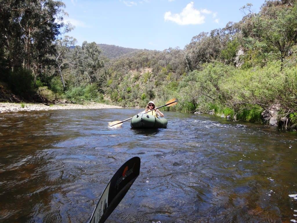
Hi Mr Ultralight Hiker,
I have a family of four two girls 11 and 12 and have been doing kayak camping for a few years now. I have invited another family to join us on a trip for Kingwill Bridge to Myers Flat. The other family of four has a 8 and 10 year old. I have read your posts of this section of the river and was wondering if it would safe to do at a higher level than you mention 1.7 to 1.8m at Waterford?
Regards
Andrew
Hi Andrew, These heights are the recommended (lower) heights below which you will find yourself having to get out a fair bit. As the river silts up as a result of willow removal and wildfire unfortunately this becomes more usual. We just canoed a section with 100 mls more water than before these events. We had to get out a dozen times where before we never had to get out (with much less water). There were heaps of places where the river was fordable with gumboots without getting your feet wet when before 2008 there were no fords which were less than thigh deep! another thing which is happening more and more is that large trees are falling into the river as Catchment ‘Management has destroyed the banks. You have to watch for these hazards more. At the moment there is 2.19 on the Waterford gauge which is 18″ (.4m) more than the height I posted about. It will be really whizzing along in narrower places and will push you under such trees much more quickly. Unlike rapids you can’t hear them coming up so you just have to be more careful. Don’t rush around bends where you can’t see the river ahead. If someone has to get out on the bank to look (if in doubt) do so. Have a signalling code set up (from the lead canoeist) to warn those following to pull over or etc. I would probably wait until it was more like 2 metres at Waterford with the children. That’s till a lot of water. There are no serious rapids in that section but there are some tricky rocks below the Rock of Gilbraltar (track). Why not start from Black Snake Creek? That way you can always pull out at Hut Creek if the children (or adults) are having problems. Have a great time on the river and enjoy your camping out. Cheers, Steve & Della.