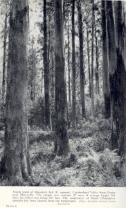
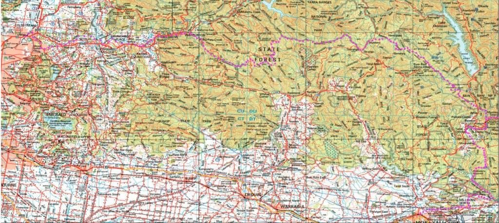
The Upper Yarra Walking Track, Australia’s oldest (& best), an approx. ten day walk with numerous resupply points, plentiful water and camping spots now extending from Moe Railway Station @ 208kilometres up the Latrobe, Tyers & Thomson River valleys, via Yallourn North, Erica & Walhalla, across the Baw Baw Plateau, along the Upper Thomson River, past the Yarra Falls & Mt Horsefall, along the Little Ada, Ada and Yarra valleys via Warburton to Lilydale Railway Station.
Full Version: http://www.finnsheep.com/THE%20UPPER%20YARRA%20WALKING%20TRACK.htm
Track Instructions: http://www.finnsheep.com/Track%20Instructions.htm
Map: Upper Yarra Track Extended:
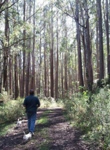
DISCLAIMER: This is a personal website. I have no authority to offer any of the contained advice, nor will I accept any responsibility for what may happen to you if you follow it. Notwithstanding, I have made every effort to ensure that the advice IS true and correct. The entire route is in a high rainfall area. You should be experienced, well-equipped bushwalkers. A fair degree of bush skill is a good idea before undertaking such a journey, as is the inclusion of a compass, map, satellite phone and epirb in your kit – and the suggested map and App on your mobile phone – there are few places along the track where the NextG phone will work (eg Mt Horsefall), so it should probably best be left in Flight Mode unless you are accessing a map/GPS location. Also WATCH THE WEATHER. Particularly on the Baw Baw Plateau heavy rain/snow, strong winds etc may occur – and indicate the journey ought not be taken in the cooler months. I will develop an alternative (lower) route which is more suitable at those times (eg along theTyers/Tanjil/Toorongo Rivers). Later I will also suggest some alternative routes should you wish to vary the trip on a later occasion. As well I will suggest some additional side-trips if you want to extend your journey. Wildfire is also a potential risk in the hotter months. There ARE poisonous snakes, the danger of falling trees etc. Some places are supposedly illegal to camp, and some places (eg along the Baw Baw Plateau, no (camp) fires are permitted. Fines may be applicable unless you obey the Eleventh Commandment: ‘Thou shall not get caught!’
I am just building this site, so DO come back.
See: TRACK INSTRUCTIONS
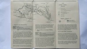
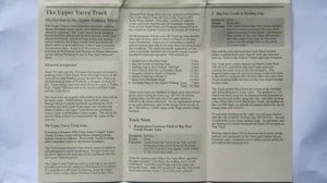
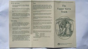
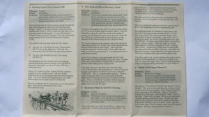
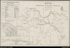
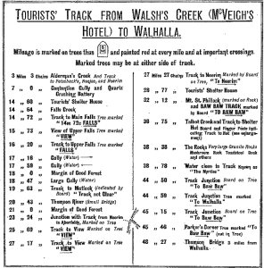
1907 Map & Track Insrtuctions: http://nla.gov.au/nla.map-rm2301
USEFUL LINKS/DOCUMENTS:
The Baw Baws A Short History W.F. Waters
1907 Map & Track Instructions: http://nla.gov.au/nla.map-rm2301
USEFUL LINKS:
Thomas Osburg has some wonderful resources about this track and other Yarra Ranges matters at his excellent website here:http://www.yarrarangesbushcamp.com/ (see also under ‘More’)
Tyers State Park: http://parkweb.vic.gov.au/__data/assets/pdf_file/0010/315766/Park-note-Tyers-Park.pdf
Mt Baw Baw Alpine Resort: http://mountbawbaw.com.au/
Walhalla Railway Line: http://en.wikipedia.org/wiki/Walhalla_railway_line
Lilydale-Warburton Rail Trail: http://www.experienceyarravalley.com.au/?eyv_activity=lilydale-warburton-rail-trail
Lilydale-Warburton Rail Trail Map: http://www.experienceyarravalley.com.au/wp-content/uploads/2014/09/warburton_rail_trail_map_2014.pdf
Wirilda Walking Track: http://www.bushwalkingvictoria.org.au/walks-directory/hard/wirilda-track-rawson.html
Wirilda Track: http://www.fedwalks.org.au/files/Walk_Descriptions/Walk_1_Wirilda_Track_-_July_Final.pdf
Wirilda Track: http://mbw.org.au/mbw_activities/MBW_tripnote.php?tripid=2007080301
Walhalla Area Track Descriptions: NBW Hut: http://www.fedwalks.org.au/files/Walk_Descriptions/Walk_21_NBW_Hut_-_July_Final.pdf
Moe – Yallourn Rail Trail: http://www.railtrails.org.au/trail?view=trail&id=207
Toorongo Falls: http://www.depi.vic.gov.au/__data/assets/pdf_file/0017/225701/Toorongo_Falls_Reserve.pdf
Walk Into History #1: http://www.depi.vic.gov.au/__data/assets/pdf_file/0003/225705/FS0033_-_Yarra_State_forest.pdf
Walk Into History #2: http://www.experienceyarravalley.com.au/?eyv_activity=walk-into-history-big-pats-creek-to-powelltown
Noojee: http://www.visitvictoria.com/Regions/Gippsland/Destinations/Noojee
Tanjil Bren: http://en.wikipedia.org/wiki/Tanjil_Bren
O’Shannessy Aqueduct Walking Trail: http://parkweb.vic.gov.au/explore/parks/yarra-ranges-national-park/things-to-do/oshannessy-aqueduct-trail
Walks around Walhalla: http://www.fedwalks.org.au/federation-2014/walks-program.html Includes Maps
Warburton Walks: http://www.warburtoninfo.com/Around-Warburton.html
Warburton: Richards Tramline Walk: http://walkaboutersvic.blogspot.com.au/2012/09/richards-tramline-yarra-ranges-sunday.html NB You could continue on to the ADA Tree.
Long Distance Walking Tracks (eg Australian Alps): http://bushwalkingnsw.org.au/clubsites/FAQ/FAQ_Expeditions.htm
Walhalla Home Page: http://www.visitwalhalla.com/
Walhalla: http://parkweb.vic.gov.au/explore/parks/walhalla-h.a
Mt Baw Baw: http://www.visitvictoria.com/Regions/Gippsland/Destinations/Mt-Baw-Baw
Mt Baw Baw Weather: http://ozforecast.com.au/cgi-bin/weather.cgi?station=Mt+Baw+Baw.VIC&radar
Erica: http://en.wikipedia.org/wiki/Erica,_Victoria
Yallourn North: http://en.wikipedia.org/wiki/Yallourn_North,_Victoria
Tyers: http://en.wikipedia.org/wiki/Tyers,_Victoria
Poverty Point Walk: http://www.bushwalkingblog.com.au/poverty-point-bridge-walk-baw-baw-national-park-walhalla-historic-area-rawson-victoria-2/
Mushroom Rocks Walk: http://www.bushwalkingblog.com.au/mushroom-rocks-baw-baw-national-park-rawson-victoria-2/
Alpine Walking Track: http://www.allydurr.com/#!read-my-blog/c1yws
Alpine Walking Track: http://bushwalk.com/forum/viewtopic.php?f=46&t=5542
Mt Whitelaw Hut:https://www.flickr.com/photos/jimharker_aus/6951765039/
Stronachs Camp – Mt St Gwinear: http://mbw.org.au/mbw_activities/MBW_tripnote.php?tripid=2010121001
Alpine Walking Track: http://www.davebyrnes.com.au/AAWT_2011/Schedule.htm
Stronachs Camp – Mt St Gwinear: https://ahhawalk.wordpress.com/tag/the-whitelaws-hut/


